
AND IT IS AN IMPACT DAY FOR US TODAY. WE ARE DEALING WITH SOME ISOLATED SNOW SQUALLS STILL AROUND THE REGION. THEN WE’RE GOING INTO A SEVERE WEATHER ALERT DAY ON TUESDAY. AS THOSE TEMPERATURES CONTINUE TO PLUMMET. IT’S NOT JUST THE ACTUAL TEMPERATURE, IT’S THE WIND CHILL. WE WILL BE UNDER A COLD WEATHER ADVISORY STARTING AT 9:00 TONIGHT UNTIL NOON ON TUESDAY, SO GUSTY WINDS AND DROPPING TEMPERATURES IN THE NAME OF THE GAME THROUGH THE AFTERNOON. PLUS WE’RE DEALING WITH SOME OF THE SNOW AGAIN. YOU CAN SEE SOME OF THESE BANDS CONTINUING TO PUSH THROUGH. WE STILL HAVE A SNOW SQUALL WARNING HERE JUST ABOUT TO EXPIRE, BUT OVERALL STILL SOME OF THAT SNOW DROPPING THE VISIBILITY AND AGAIN BRINGING THE SNOW LIGHT ACCUMULATIONS. WE’RE LOOKING AROUND A HALF AN INCH TO AN INCH. SOME SPOTS WHERE UP TO TWO ALREADY INTO BUTLER AND BEAVER. BUT THIS WILL MOVE ON OUT AS WE CONTINUE THROUGH THE AFTERNOON. BY 4:00 5:00 THINGS QUIET DOWN WITH THE SNOW, AND THEN WE’RE GOING TO BE USHERING IN ALL OF THAT COLD AIR. IT’S ALREADY COLD OUTSIDE, BUT IT’S JUST GOING TO GET WORSE TONIGHT. NOW, I WANTED TO SHOW YOU TWO CAMERAS BECAUSE THE SNOW SQUALL IS MOVING THROUGH. THAT’S THE PARKWAY EAST. THIS IS ABOVE OUR STATION HERE IN WILKINSBURG. YOU CAN SEE HOW THE VISIBILITY DROPS. THEN AS WE GO INTO THE CITY, NO SNOW SQUALLS MOVING THROUGH. THE VISIBILITY IS GREAT. SO THAT’S THE DIFFERENCE. THESE BANDS CAN REALLY WREAK HAVOC IF YOU GET STUCK IN ONE DRIVING. IT CAN BE A LITTLE TRICKY FOR YOU. SO JUST KEEP THAT IN MIND. WE WILL HAVE THESE SNOW SQUALLS THE NEXT COUPLE OF HOURS. THAT ARCTIC SNAP STICKS AROUND. WE’LL HAVE SOME SUNSHINE TOMORROW. WE ALREADY HAD A LITTLE BIT OF SUNSHINE TODAY, BUT IT’S NOT GOING TO HELP US OUT TOO MUCH. TEMPERATURES DO REBOUND BACK INTO THE 30S ON WEDNESDAY, BUT ANOTHER WAVE OF ENERGY, ANOTHER FRONT COMING IN. IT’S A QUICK CLIPPER. IT’S GOING TO BRING ANOTHER POTENTIALLY HALF AN INCH TO AN INCH AROUND THE AREA. SO NOT A LOT OF SNOW LOOKS TO BE IN THE AFTERNOON. THAT COLD SNAP THOUGH BACK IN AS WE GET INTO THE WEEKEND AND INTO NEXT WEEK. SO WINDS RIGHT NOW LOOK AT NEWCASTLE 40MPH, GREENSBURG REPORTING 44 MILE PER HOUR WIND GUSTS. SO A LOT OF US 25 TO NOW UP TO 45MPH. AND IT IS KNOCKING THOSE WIND CHILLS DOWN ALREADY SINGLE DIGITS AND LOW TEENS. THESE NUMBERS WILL CONTINUE TO DROP BY THE TIME WE GET INTO THE EVENING. THIS IS AROUND 8:00. WE’LL HAVE SUBZERO WIND CHILLS ABOUT 3 TO 6 BELOW. EVEN SOME SPOTS NEAR TEN. THEY DROP MORE FOR TOMORROW MORNING. THIS IS VERY DANGEROUS. COLD AIR IN PLACE 10 TO 20 DEGREES BELOW ZERO. WAKING UP TOMORROW MORNING. THEY REALLY DON’T IMPROVE TOO MUCH THROUGH THE MORNING HOURS AS WE GET AROUND LUNCHTIME WE’LL STILL BE SUB SUBZERO. EXCUSE ME, BUT ABOUT 2 TO 8 DEGREES BELOW. SO AGAIN, IT’S GOING TO GET VERY COLD. WE SHOULD GET OUT OF SUBZERO WIND CHILLS AS WE GET INTO THE EVENING. ON OUR TUESDAY. THERE’S YOUR FOUR DAY PLUS FOUR MORE FORECAST IMPACT DAY TO SEVERE WEATHER ALERT DAY. WITH ALL OF THIS COLD AIR IN PLACE, A LITTLE BIT OF A BREAK FROM THE COLD AIR, BUT THEN SOME MORE LIGHT SNOW COMES IN WEDNESDAY. WE WILL SEE A BREAK. CURRENTLY LOOKS LIKE FRIDAY AND SATURDAY. THERE’S A CHANCE FOR A FEW SNOWFLAKES SUNDAY. RIGHT NOW, MAYBE 1 TO 2IN, BUT IT’S GOING TO
Snow squall warning issued for Western Pennsylvania on Monday

Updated: 2:22 PM EST Jan 19, 2026
Monday is an Impact Day in western Pennsylvania. A snow squall warning has been extended into Monday afternoon for several counties.VIDEO ABOVE: Watch the latest forecast from Pittsburgh’s Action WeatherThe National Weather Service said a snow squall warning is in effect for parts of Fayette, Washington and Indiana counties until 2:30 p.m. More: Read the alerts for your countyInteractive radar: Track snow as it moves through your areaThe NWS said a dangerous snow squall was located along a line from 23 miles southeast of Punxsutawney to over Uniontown, or along a line from 21 miles east of Indiana to over Uniontown, moving east at 30 mph.HAZARD…Whiteout conditions with near zero visibility associated with intense bursts of snow and blowing snow. Wind gusts greater than 35 mph.SOURCE…Doppler radar and webcams.IMPACT…Travel will become difficult and potentially dangerous within minutes.Locations impacted include Uniontown, Connellsville, Mount Pleasant, Scottdale, South Connellsville, Ligonier, Seven Springs, Dunbar, Everson, New Florence, Seward, Vanderbilt, Bolivar, Dawson, New Salem, Laurel Mountain, Armagh, Donegal, Champion and Indian Head.This includes Pennsylvania Turnpike between mile markers 83 and 99.PRECAUTIONARY/PREPAREDNESS ACTIONS… Slow Down! Rapid changes in visibility and road conditions are expected with this dangerous snow squall. Be alert for sudden whiteout conditions.There is no safe place on a highway when a snow squall hits. Visibility and traction are immediately lost in whiteout conditions, making it difficult or impossible to slow down and avoid stopped vehicles. Delay travel or safely exit the highway before the snow squall arrives.WTAE app: Download now to stay connected with breaking news & weatherSevere weather alerts: Sign up to receive free alerts to your phone or emailThe National Weather Service said a snow squall warning is in effect for Armstrong, Clarion, Forest, Indiana and Venango counties until 2:15 p.m. (The warning has expired for Butler County.)More: Read the alerts for your countyInteractive radar: Track snow as it moves through your areaThe NWS said a dangerous snow squall was located along a line from 9 miles north of Clarion to 9 miles northwest of Indiana, or along a line from 9 miles northeast of Knox to 9 miles northwest of Indiana, moving east at 30 mph.HAZARD…Whiteout conditions with near zero visibility associated with intense bursts of snow and blowing snow. Wind gusts greater than 35 mph.SOURCE…Doppler radar and webcams.IMPACT…Travel will become difficult and potentially dangerous within minutes.Locations impacted include Oil City, Franklin, Punxsutawney, Clarion, Brookville, Marienville, Knox, Sugarcreek, Reynoldsville, Brockway, New Bethlehem, Tionesta, Hasson Heights, Clymer, Sykesville, Falls Creek, Seneca, Rural Valley, Big Run and Dayton. This includes Interstate 80 between mile mile markers 59 and 96.PRECAUTIONARY/PREPAREDNESS ACTIONS… Slow Down! Rapid changes in visibility and road conditions are expected with this dangerous snow squall. Be alert for sudden whiteout conditions. There is no safe place on a highway when a snow squall hits. Visibility and traction are immediately lost in whiteout conditions, making it difficult or impossible to slow down and avoid stopped vehicles. Delay travel or safely exit the highway before the snow squall arrives.WTAE app: Download now to stay connected with breaking news & weatherSevere weather alerts: Sign up to receive free alerts to your phone or emailCold weather advisoryThe National Weather Service said the following counties will be under a cold weather advisory starting at 9 p.m. Monday: Mercer, Venango, Forest, Lawrence, Butler, Clarion, Beaver, Allegheny, Armstrong, Washington, Westmoreland, High Elevations of Westmoreland, Higher Elevations of Fayette, and Higher Elevations of Indiana.The cold weather advisory is expected to remain in place until noon Tuesday.Very cold wind chills as low as 15 degrees below zero are expected.Officials say to exercise caution while traveling outside and make sure to wear appropriate clothing, such as hats, gloves, and scarves.Frigid air and brutal wind chills Tuesday – Alert DayTemperatures will keep dropping with air temperatures in the lower single digit digits by Tuesday morning.Tuesday is a Severe Weather Alert Day as wind chills will likely reach 10 degrees below zero and remain sub-zero through the day. Wind chills could be as cold as 30 below zero in the Laurel Highlands in the morning.High temperatures will struggle back to the teens, but it won’t feel like that at any point in the day.Improving temperatures late weekTemperatures will improve as we head through the end of next week. Highs will climb above freezing as early as Wednesday. We are watching the potential for a little more snow Wednesday and Thursday. Another blast of frigid air will arrive in time for next weekend.
PITTSBURGH —
Monday is an Impact Day in western Pennsylvania. A snow squall warning has been extended into Monday afternoon for several counties.
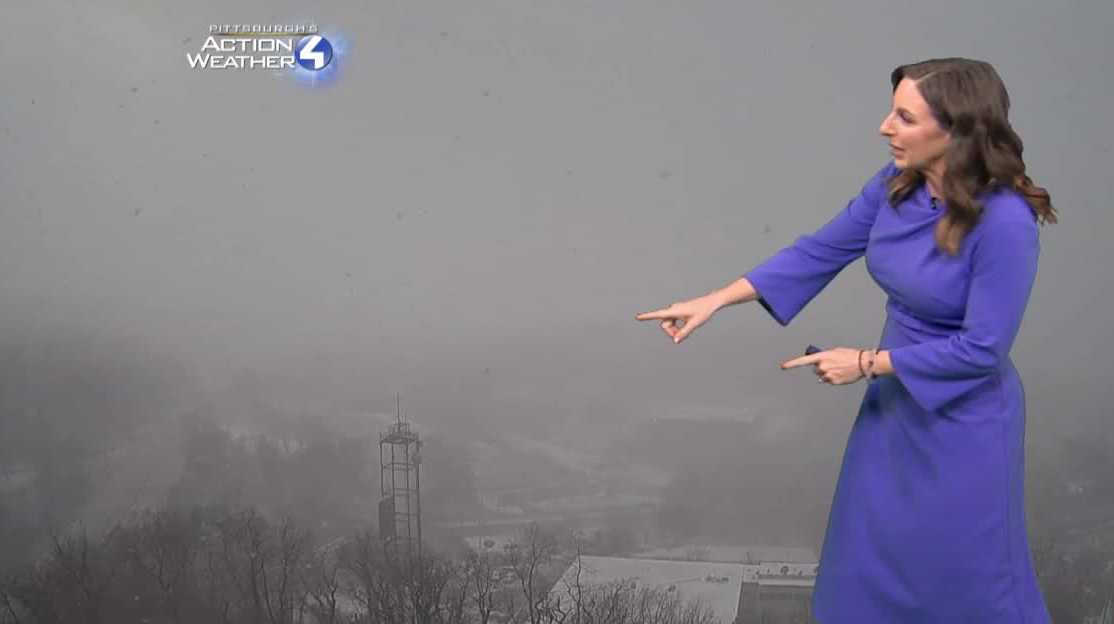
VIDEO ABOVE: Watch the latest forecast from Pittsburgh’s Action Weather
The National Weather Service said a snow squall warning is in effect for parts of Fayette, Washington and Indiana counties until 2:30 p.m.
The NWS said a dangerous snow squall was located along a line from 23 miles southeast of Punxsutawney to over Uniontown, or along a line from 21 miles east of Indiana to over Uniontown, moving east at 30 mph.
HAZARD…Whiteout conditions with near zero visibility associated with intense bursts of snow and blowing snow. Wind gusts greater than 35 mph.
SOURCE…Doppler radar and webcams.
IMPACT…Travel will become difficult and potentially dangerous within minutes.
Locations impacted include Uniontown, Connellsville, Mount Pleasant, Scottdale, South Connellsville, Ligonier, Seven Springs, Dunbar, Everson, New Florence, Seward, Vanderbilt, Bolivar, Dawson, New Salem, Laurel Mountain, Armagh, Donegal, Champion and Indian Head.
This includes Pennsylvania Turnpike between mile markers 83 and 99.
PRECAUTIONARY/PREPAREDNESS ACTIONS… Slow Down! Rapid changes in visibility and road conditions are expected with this dangerous snow squall. Be alert for sudden whiteout conditions.
There is no safe place on a highway when a snow squall hits. Visibility and traction are immediately lost in whiteout conditions, making it difficult or impossible to slow down and avoid stopped vehicles. Delay travel or safely exit the highway before the snow squall arrives.
The National Weather Service said a snow squall warning is in effect for Armstrong, Clarion, Forest, Indiana and Venango counties until 2:15 p.m. (The warning has expired for Butler County.)
The NWS said a dangerous snow squall was located along a line from 9 miles north of Clarion to 9 miles northwest of Indiana, or along a line from 9 miles northeast of Knox to 9 miles northwest of Indiana, moving east at 30 mph.
HAZARD…Whiteout conditions with near zero visibility associated with intense bursts of snow and blowing snow. Wind gusts greater than 35 mph.
SOURCE…Doppler radar and webcams.
IMPACT…Travel will become difficult and potentially dangerous within minutes.
Locations impacted include Oil City, Franklin, Punxsutawney, Clarion, Brookville, Marienville, Knox, Sugarcreek, Reynoldsville, Brockway, New Bethlehem, Tionesta, Hasson Heights, Clymer, Sykesville, Falls Creek, Seneca, Rural Valley, Big Run and Dayton. This includes Interstate 80 between mile mile markers 59 and 96.
PRECAUTIONARY/PREPAREDNESS ACTIONS… Slow Down! Rapid changes in visibility and road conditions are expected with this dangerous snow squall. Be alert for sudden whiteout conditions. There is no safe place on a highway when a snow squall hits. Visibility and traction are immediately lost in whiteout conditions, making it difficult or impossible to slow down and avoid stopped vehicles. Delay travel or safely exit the highway before the snow squall arrives.
Cold weather advisory
The National Weather Service said the following counties will be under a cold weather advisory starting at 9 p.m. Monday: Mercer, Venango, Forest, Lawrence, Butler, Clarion, Beaver, Allegheny, Armstrong, Washington, Westmoreland, High Elevations of Westmoreland, Higher Elevations of Fayette, and Higher Elevations of Indiana.
The cold weather advisory is expected to remain in place until noon Tuesday.

Very cold wind chills as low as 15 degrees below zero are expected.
Officials say to exercise caution while traveling outside and make sure to wear appropriate clothing, such as hats, gloves, and scarves.
Frigid air and brutal wind chills Tuesday – Alert Day
Temperatures will keep dropping with air temperatures in the lower single digit digits by Tuesday morning.
Tuesday is a Severe Weather Alert Day as wind chills will likely reach 10 degrees below zero and remain sub-zero through the day. Wind chills could be as cold as 30 below zero in the Laurel Highlands in the morning.
High temperatures will struggle back to the teens, but it won’t feel like that at any point in the day.

Improving temperatures late week
Temperatures will improve as we head through the end of next week. Highs will climb above freezing as early as Wednesday. We are watching the potential for a little more snow Wednesday and Thursday. Another blast of frigid air will arrive in time for next weekend.

Hearst OwnedHearst
Temperatures recover Wednesday afternoon. Another bitter blast is in the work for next weekend.