
Oregon’s snowpack has fallen to its lowest level on record for this time of year, part of a broader snow drought gripping the Pacific Northwest and raising concerns about water supplies, wildfire risk and impacts to farms and fisheries.
Climatologists from Oregon, Washington and Idaho said during a regional drought briefing Wednesday that unusually warm temperatures — not just a lack of precipitation — have driven snowpack to historic lows across much of the region.
Oregon’s statewide snow water equivalent, a measure of the water stored in snowpack, ranks at the zero percentile, meaning it is the lowest in the historical record for this date, climatologists reported. Snowpack typically acts as a natural reservoir, storing water during winter and slowly releasing it in spring and summer to supply irrigation, drinking water, fish habitat and hydropower.
“This year, even if we receive a normal amount of snow from here on out, we’re still looking at historically bad conditions,” said Larry O’Neill, Oregon’s state climatologist.
November through January was the warmest such three-month period on record in Oregon, averaging about 7 degrees above normal. January also ranked among the driest on record. The result has been both a “warm snow drought,” when precipitation falls as rain instead of snow, and increasingly a “dry snow drought,” as storms have largely missed the state in recent weeks.
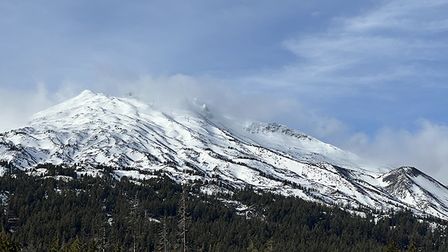
The impacts are already visible. Several Oregon ski areas have suspended operations, and webcams at Willamette Pass show large stretches of bare ground where snow typically blankets the slopes, O’Neill said.
In Central Oregon, Hoodoo Ski Area remains closed this week even after getting a few inches of snow last weekend.
The situation echoes 2015, one of the state’s worst drought years. That summer, all of Oregon fell into severe or extreme drought, and 25 of 36 counties received drought declarations. Researchers later linked the low-snow winter to reduced irrigation supplies, stressed fisheries and a 10% to 15% decline in hydroelectric power generation.
“If these conditions continue, we expect similar outcomes this summer,” O’Neill said.
Across the broader Columbia River Basin — which includes parts of Oregon, Washington and Idaho — snowpack ranks in the second percentile, meaning levels are lower than 98% of years on record for this date.
Low snowpack can lead to lower and warmer streamflows later in summer, conditions that can harm salmon and strain irrigation supplies. Fire experts said it is too early to predict the severity of the upcoming wildfire season, but below-normal snowpack typically means an earlier start and longer duration for fires, particularly if late spring is warm and dry.
Washington’s statewide snowpack sits at about 51% of normal, the third lowest since 1985. October through January marked the warmest start to a water year on record for the state. Heavy December rains boosted some reservoir levels, but much of that precipitation fell as rain rather than snow, limiting long-term water storage.
“Most of our snowpack-building season has already passed,” said Karin Bumbaco, deputy state climatologist for Washington. “It would take near-record snowfall from here on out to get us back to normal by April 1.”
Idaho’s outlook is mixed.
Some higher-elevation basins have near- or above-normal snowpack because colder temperatures allowed storms to fall as snow, according to David Hoekema, a hydrologist with the Idaho Department of Water Resources.
But many lower-elevation basins, including the Boise and Payette, are unlikely to recover to normal levels this season, he said. Northern Idaho is facing what could become its fourth consecutive year of drought.
“This is the first time Idaho has experienced a wet snow drought” at this scale, Hoekema said, referring to a winter in which precipitation totals are near normal but unusually warm temperatures cause more rain than snow. “We’ve had the precipitation. It just hasn’t built a snowpack for us.”
Forecasters said a more active weather pattern over the next two weeks could bring additional mountain snowfall, but it is unlikely to erase the deficits.
For Oregon, the outlook remains especially concerning.
Snowpack above about 4,000 to 5,000 feet functions as the state’s primary water storage system. Without it, rivers can run low and warm earlier in the year, affecting farms, fish and power production.
“These conditions are very concerning for our water supply, our food supply and our recreation opportunities,” O’Neill said. “We may be looking at a challenging summer ahead.”