
PORTLAND (WGME) — Despite a few recent rounds of rain, we’re still running a deficit, and the drought isn’t going anywhere just yet.
Drought impacts nearly every part of our lives. Everything in our environment is connected, and water plays a critical role. It supports our communities, our ecosystems and our economy.
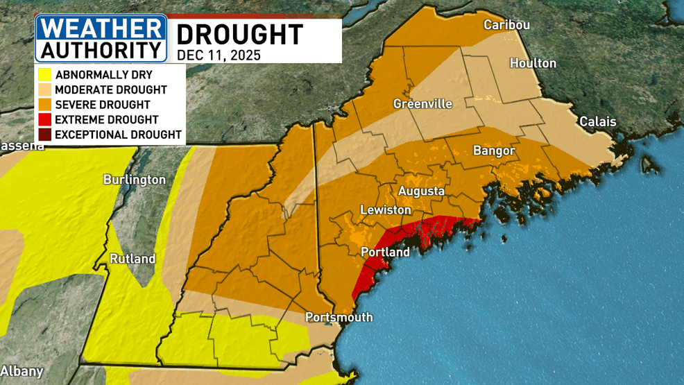
The drought in Maine has been ongoing since last spring.
The drought monitor from December 2025 shows a large portion of coastal communities still in severe to extreme drought, with every county experiencing at least moderate drought conditions.
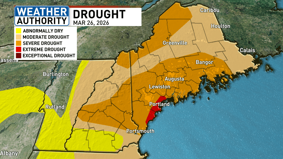
Current drought monitor – March 26 (WGME).
Fast forward to Friday’s drought monitor, there have been only minor improvements. The state is still under drought conditions, with parts of southern Maine remaining in extreme drought.
So how did the drought in Maine become so extreme?
To understand drought, it helps to look at something called the water year.
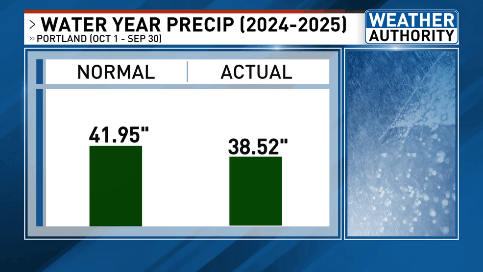
Last year’s water year precipitation vs. normal (WGME).
Instead of following the calendar year, the water year runs from October 1 through September 30.
This timeframe is used because it better captures how water moves through the environment, starting in the fall, when soils begin to recharge, and continuing through spring snowmelt and summer use.
During the last water year, when the drought really began to ramp up, we stayed in a precipitation deficit from October 2024 through September 2025 in Portland. While the deficit wasn’t extreme, above-average summer temperatures helped dry things out.
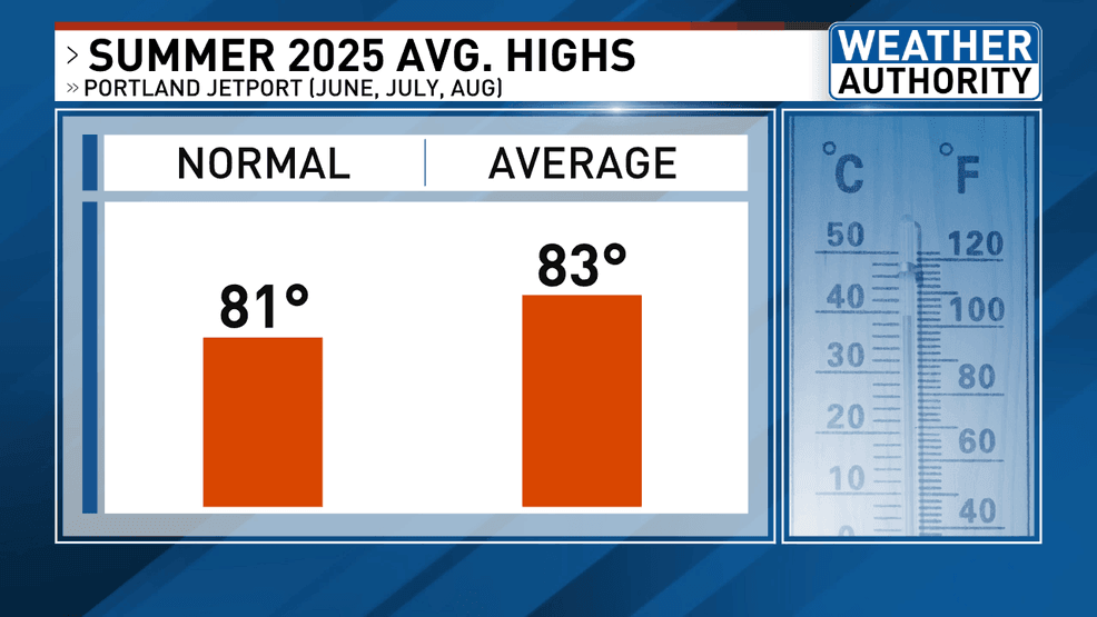
Summer 2025 average high temperatures (WGME).
During meteorological summer last year, temperatures averaged about two degrees above normal for all three months in Portland.
That added heat helped dry out the landscape, and combined with the rainfall deficit, created the perfect setup for drought conditions.
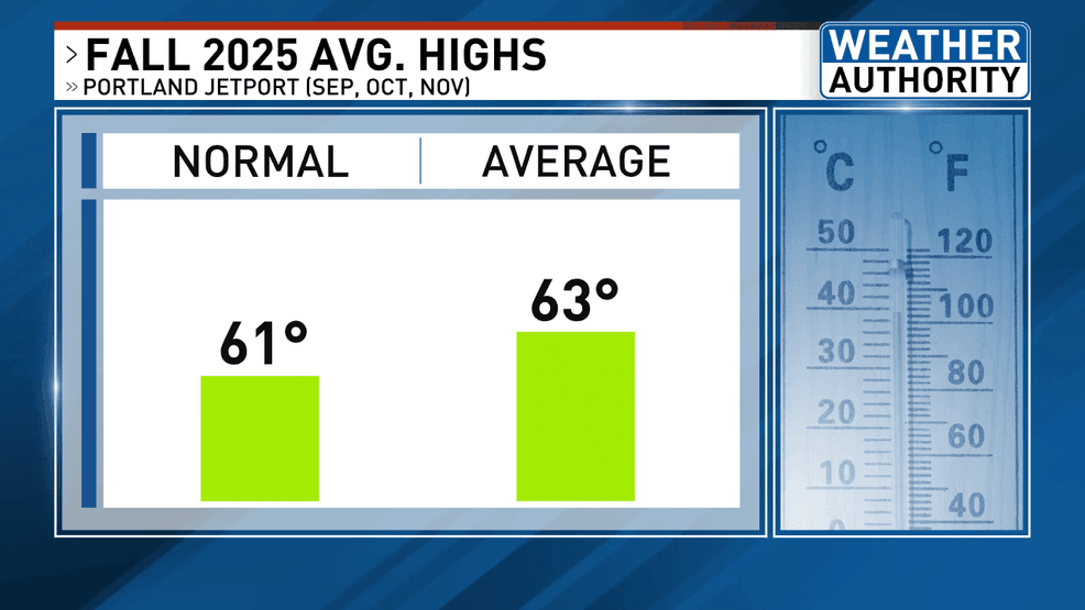
Fall 2025 average high temperatures (WGME).
Temperatures stayed above normal into meteorological fall as well, averaging about two degrees above normal in Portland.
That prolonged warmth, combined with below-average precipitation, helped push Maine into extreme drought.
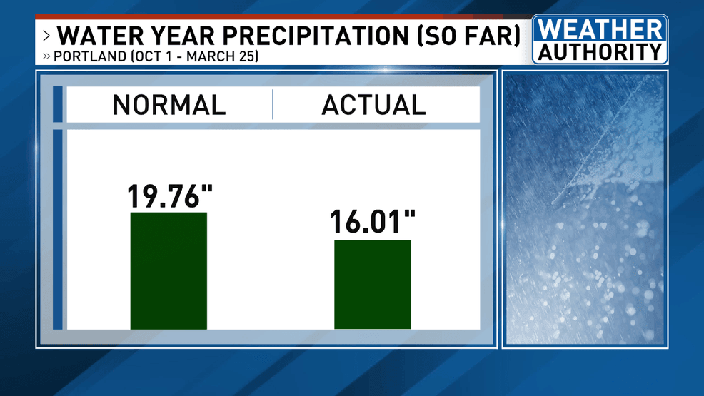
This water year precipitation to date (WGME).
So far this water year, which began on October 1, 2025, we’re still running a precipitation deficit.
Normally, we’d have picked up just under 20 inches of precipitation by March 25, but right now, we’re nearly 4 inches below that.
Where do we go from here?
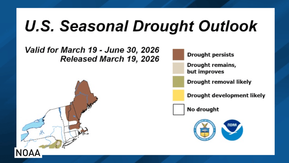
Seasonal drought outlook – March through end of June (WGME).
The Climate Prediction Center is forecasting that the drought will persist through at least the end of June, a reflection of the ongoing precipitation deficit.
To get out of the severe drought, Maine will need multiple days of soaking precipitation.
Although this winter has been cold, we are still in a deficit when it comes to water.
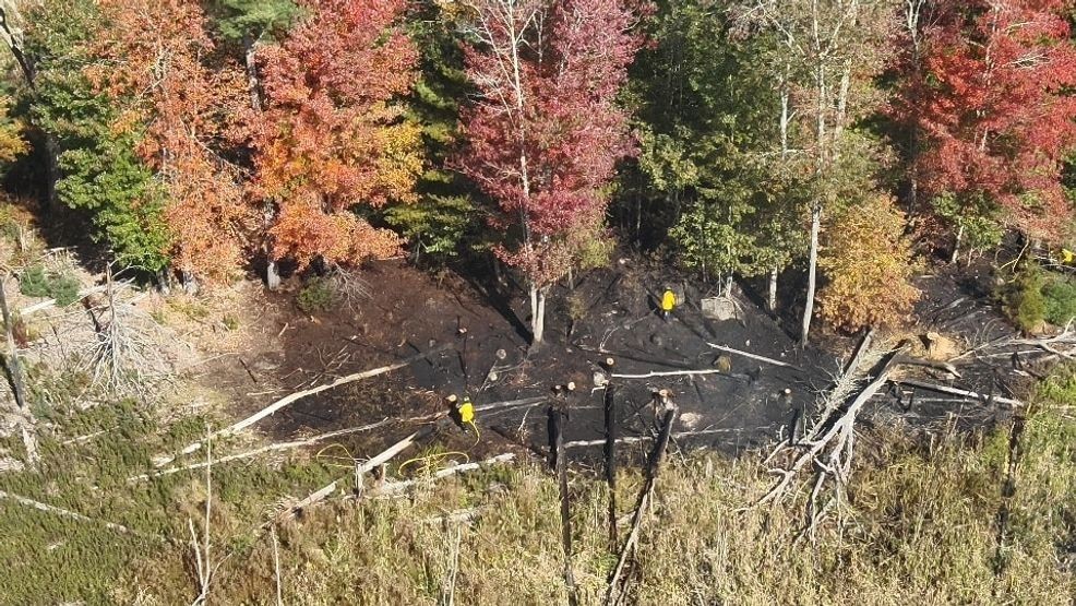
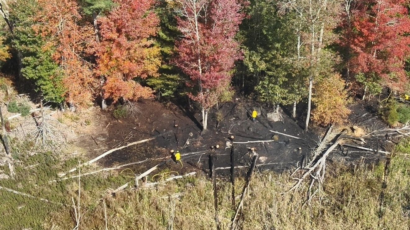
Wildfires last year in Maine (Maine Forest Service).
Hundreds of wells went dry last year from severe drought.
Drought doesn’t just impact the environment, it affects our daily lives, too. Lower water levels can strain water supplies, increase the risk of wildfires and even impact the cost and availability of certain foods.
That’s especially true for farmers. With less rainfall, soil moisture drops, making it harder for crops to grow and thrive. Many farmers have to rely more on irrigation, which raises costs, and in some cases, leads to lower yields.