
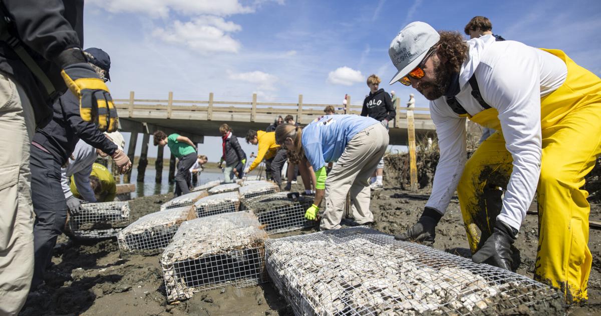
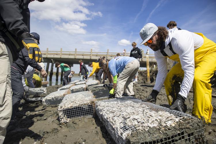
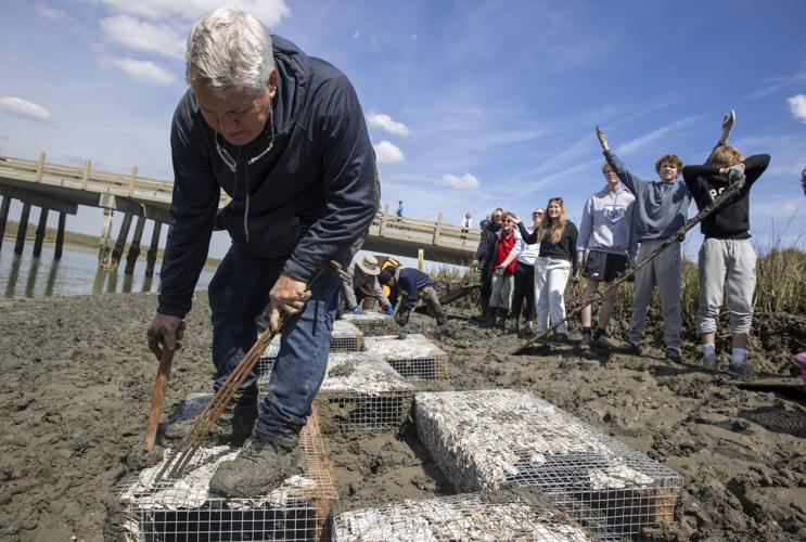
KIAWAH ISLAND — Slipping, sliding and squelching through the pluff mud, the group of high schoolers carefully placed the artificial wire reefs filled with oysters shells and spartina seed in a checkerboard pattern along the bank of the Kiawah River. Traffic whizzed past on the nearby Kiawah River Parkway as pedestrians stopped to observe the work.
If all goes according to plan, this artificial reef will soon take root and weave itself seamlessly into the ecological fiber of Kiawah River’s tidal marshes.

Volunteers and SCDNR workers take plants of wood onto the marsh shore to create walkable paths through the mud, Wednesday, March 18, 2026, in Kiawah Island.
Henry Taylor/Staff

The Post and Courier’s Rising Waters Lab focuses on impacts of climate change and related policies and practices. It is supported by donations and grants to the nonprofit Public Service and Investigative Fund, whose contributors are subject to the same coverage we apply to everyone else. For more information and to make a donation, go to postandcourierfund.com.
To sign up for our newsletter, click here.
Living shorelines like this one are becoming an increasingly common tool across South Carolina to hold back rising tides, filter polluted runoff and stabilize rapidly eroding shorelines.
This particular project has a specific goal in mind: shielding Kiawah Island’s sole road to the mainland from rising seas and erosion. The Kiawah Island Parkway is just one stretch of a growing network of South Carolina roads that could become increasingly vulnerable to flooding and rising tides.
“ We’ve noticed that some of the banks are sort of eroding away near the Kiawah River Bridge, and there’s just a slight concern it might start impacting the bridge,” said Lee Bundrick, the senior ecological health and conservation coordinator with the Conservancy of the Sea Islands, which is organizing this project.
South of Charleston, South Carolina, Kiawah Island has one road for visitors to take when getting on and off. As rising sea levels change shores across the coast see one project aimed at preventing this roadway from falling away.
By Henry Taylor htaylor@postandcourier.com
Across this stretch of the river, the Conservancy has planted other living shorelines to stabilize the marsh.
“The Kiawah River Bridge is the only ingress and egress spot on Kiawah Island, so it’s incredibly important infrastructure,” Bundrick noted. “The marsh around it is also important natural infrastructure. By helping protect that marsh in that area, we’re helping protect this bridge area from erosion.”
In an email, Brian Gottshalk, public works director for Kiawah Island, wrote that erosion hasn’t been much of a threat to the Kiawah River Bridge nor Parkway, but the town keeps its eyes on the marsh line to ensure the infrastructure’s security. He added that, while parts of the road occasionally flood, the inundation is often quick to subside with the falling tide.
Monte Anthony passes wire reef materials to volunteers along the shore of Kiawah Island, Wednesday, March 18, 2026.
Henry Taylor/Staff
But elsewhere, flooding and rising tides pose a pressing threat to South Carolina’s low-lying roads.
‘Hundreds of miles’
The S.C. Office of Resilience reports that “hundreds of miles of (South Carolina) roads are at risk of high-tide flooding.” The department anticipates the total number of flood-vulnerable roads will increase over the coming decades as sea levels rise.
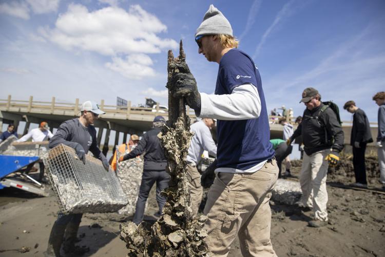
Oliver Robb, with the Sustainability Institute, holds onto a pole covered in oysters while navigating the shore, Wednesday, March 18, 2026, in Kiawah Island.
Henry Taylor/Staff
The S.C. Emergency Management Division, in partnership with Clemson University, has an ongoing project to map flood-vulnerable roads. Prior to this initiative, the state didn’t have a clear map of such vulnerabilities.
“ We even went down to South Carolina Department of Transportation to try to get the information,” said David Vaughn, the director of Clemson Engineers for Developing Communities and the project’s leader. “It didn’t exist.”
DOT manages more than 8,400 bridges across the state and 41,000 miles of South Carolina’s 60,000-plus mile public road system, according to the Resilience Office. That puts them in charge of the fourth-largest state-maintained highway system in America.
Using satellite images, FEMA data, and information held by different government departments, the Clemson team is pulling together a road elevation model that can map flood vulnerabilities.
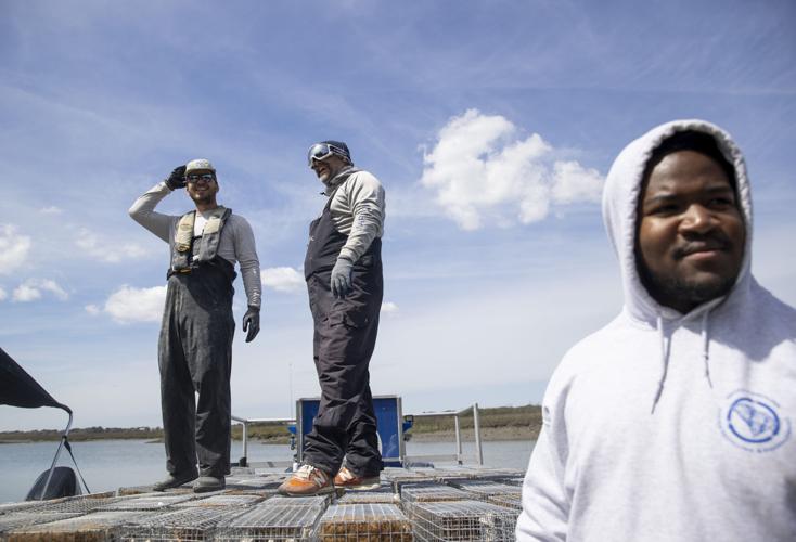
(from left to right right) Aiden Richter, Art Perry, and Bernard Brown wait for volunteers before pushing off with their landing ship to deliver manufactured wire reefs to a site to construct a living shoreline, Wednesday, March 18, 2026, in Kiawah Island.
Henry Taylor/Staff
Vaughn said it’s been like trying to assemble a puzzle where all of the pieces are scattered across federal and state government agencies. He said his eventual goal is to create a database where their findings are easily available.
While that project is ongoing, another analysis could offer a broad-stroke look at the issue.
A 2019 report co-published by the National Oceanic and Atmospheric Administration, University of Georgia, S.C. Sea Grant Consortium, and several other groups found that 37 miles of Charleston County roads are at risk of inundation with one foot of sea level rise. That’s the amount the city is predicted to experience by 2050.
While exact forecasts vary beyond 2050, the seas will continue to rise for the foreseeable future. Charleston’s Water Plan, which guides the city’s long-term planning as tides surge, predicts anywhere from two to four feet of sea-level rise by 2070.
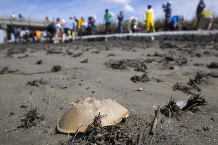
The shell of a horseshoe crab rests on the shore next to a manufactured wire reef construction project, Wednesday, March 18, 2026, in Kiawah Island.
Henry Taylor/Staff
That means more inundated roads. Tack on two feet of sea level rise to their 2019 levels, and the number of vulnerable roads rises to 82 miles. Boost things to three feet, and the tally jumps to 229 miles.
And that’s just in Charleston County.
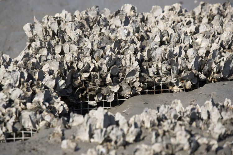
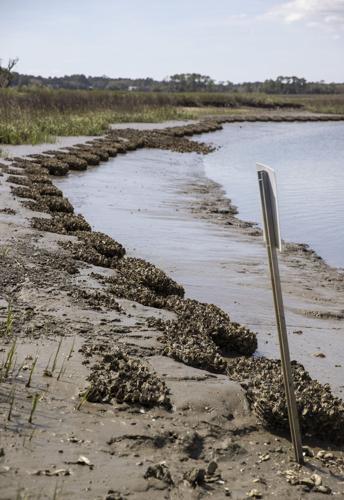
A living shoreline made of manufactured wire reefs that was placed two years ago sits on the marsh shore covered in growing oysters and holding back sediment, Wednesday, March 18, 2026, in Kiawah Island.
Henry Taylor/Staff
Washed out roads or bridges are more than an annoyance. As the Resilience Office reports, “roads and bridges are essential to evacuation and response, and for the delivery of longer-term recovery resources.”
“ The entire county is very uniquely vulnerable to flooding just because of our elevation, or lack thereof,” said Justin Pierce, Charleston County’s emergency management director. ”It’s obviously of particular concern to our coastal communities like Kiawah and Folly Beach that are particularly at risk because they only rely on one or two roadways to access the mainland.”
A 2019 analysis found that roads across coastal South Carolina are vulnerable to rising seas and increased flooding. This map breaks down the total number of state, local and privately-managed road miles in each coastal county threatened by different stages of sea level rise. Tap or hover over highlighted counties to read more.
1 FT 2 FT 3 FT
Pierce said Charleston County Emergency Management will pre-position teams and supplies across the region ahead of a severe weather event, in the event that a road or bridge is made impassable.
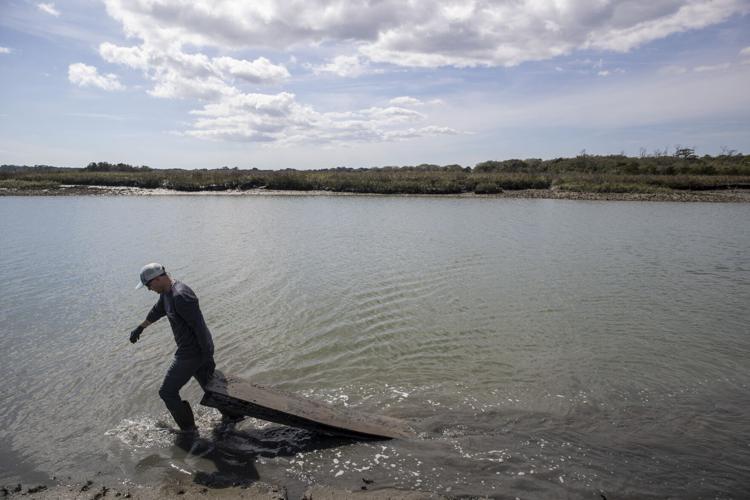
People walk planks of wood used as walking platforms up the shore to create new paths for laying manufactured wire reefs, Wednesday, March 18, 2026, in Kiawah Island.
Henry Taylor/Staff
‘Have a good attitude’
The Department of Natural Resources boat was loaded down with manufactured oyster reefs and awaiting its final passenger. Jake Peavy, a sophomore at Johns Island’s Charleston Collegiate School, was getting ready to board and head back out to the marsh for round two of the oyster build.
“We actually, a few months ago, made the reefs we’re putting in the water today,” he said. “We have a wonderful coastal town here, and I just want to contribute the way I can.”
Peavy’s clothes were plastered with pluff mud. Still, he was much cleaner than some of his peers.
Volunteers and SCDNR employees unload manufactured wire reefs from their landing craft and onto the shore of Kiawah Island to build a living shoreline, Wednesday, March 18, 2026, in Kiawah Island.
Henry Taylor/Staff
“Some of my friends have been suffering through it, but I’ve tried to have a good attitude about it,” he said.
Peavy dashed over to the boat, taking a seat beside his muddied friends. They laughed as the boat pulled back from the Mingo Point boat landing and puttered upstream to the work site.
Close
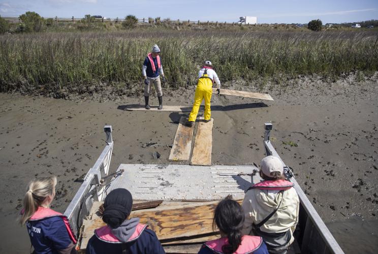
Volunteers and SCDNR workers take plants of wood onto the marsh shore to create walkable paths through the mud, Wednesday, March 18, 2026, in Kiawah Island.
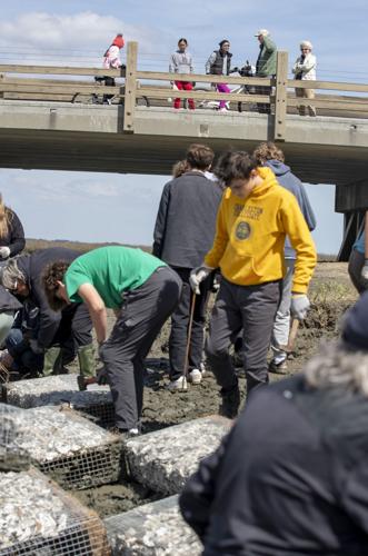
Passersby walking and cycling on the bridge look down at volunteers and SCDNR employees laying manufactured wire reefs to create a more sturdy shoreline and prevent erosion, Wednesday, March 18, 2026, in Kiawah Island.
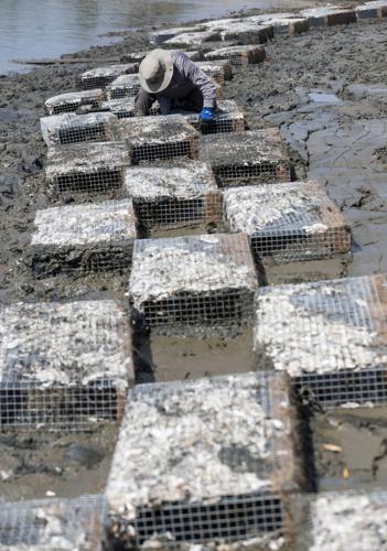
Shep McKinley pushes and hammers in pieces of rebar to plant manufactured wire reefs used to bolster shorelines, Wednesday, March 18, 2026, in Kiawah Island.
People walk planks of wood used as walking platforms up the shore to create new paths for laying manufactured wire reefs, Wednesday, March 18, 2026, in Kiawah Island.
A living shoreline made of manufactured wire reefs that was placed two years ago sits on the marsh shore covered in growing oysters and holding back sediment, Wednesday, March 18, 2026, in Kiawah Island.
Nick Plaisted (right) helps spread out manufactured wire reefs to install and build a living shoreline with at the Kiawah Island bridge, Wednesday, March 18, 2026, in Kiawah Island.

Monte Anthony passes wire reef materials to volunteers along the shore of Kiawah Island, Wednesday, March 18, 2026.
(from left to right right) Aiden Richter, Art Perry, and Bernard Brown wait for volunteers before pushing off with their landing ship to deliver manufactured wire reefs to a site to construct a living shoreline, Wednesday, March 18, 2026, in Kiawah Island.
The shell of a horseshoe crab rests on the shore next to a manufactured wire reef construction project, Wednesday, March 18, 2026, in Kiawah Island.
Oliver Robb, with the Sustainability Institute, holds onto a pole covered in oysters while navigating the shore, Wednesday, March 18, 2026, in Kiawah Island.
A living shoreline made of manufactured wire reefs that was placed two years ago sits on the marsh shore covered in growing oysters and holding back sediment, Wednesday, March 18, 2026, in Kiawah Island.
Mike Henry pushes in pieces of rebar to install manufactured wire reefs along the shore near the Kiawah Island bridge, Wednesday, March 18, 2026, in Kiawah Island.
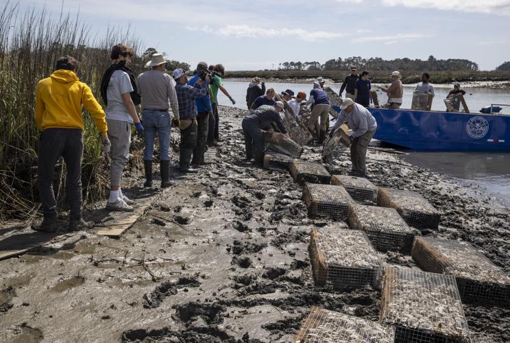
Volunteers and SCDNR employees spread out and install Manufactured Wire Reefs along the shore near Kiawah Island Bridge, Wednesday, March 18, 2026, in Kiawah Island.
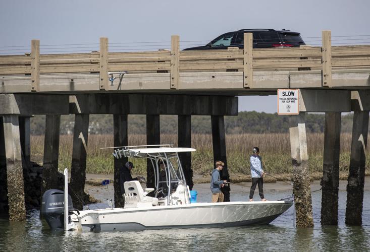
People fish from a boat underneath the Kiawah Island Bridge, Wednesday, March 18, 2026, in Kiawah Island.
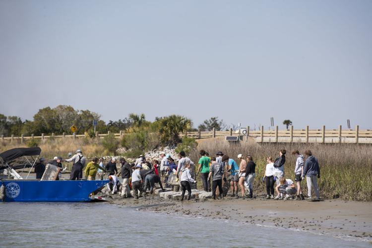
Volunteers and SCDNR employees unload manufactured wire reefs from their landing craft and onto the shore of Kiawah Island to build a living shoreline, Wednesday, March 18, 2026, in Kiawah Island.
Volunteers and SCDNR workers take plants of wood onto the marsh shore to create walkable paths through the mud, Wednesday, March 18, 2026, in Kiawah Island.
Passersby walking and cycling on the bridge look down at volunteers and SCDNR employees laying manufactured wire reefs to create a more sturdy shoreline and prevent erosion, Wednesday, March 18, 2026, in Kiawah Island.
Shep McKinley pushes and hammers in pieces of rebar to plant manufactured wire reefs used to bolster shorelines, Wednesday, March 18, 2026, in Kiawah Island.
People walk planks of wood used as walking platforms up the shore to create new paths for laying manufactured wire reefs, Wednesday, March 18, 2026, in Kiawah Island.
A living shoreline made of manufactured wire reefs that was placed two years ago sits on the marsh shore covered in growing oysters and holding back sediment, Wednesday, March 18, 2026, in Kiawah Island.
Nick Plaisted (right) helps spread out manufactured wire reefs to install and build a living shoreline with at the Kiawah Island bridge, Wednesday, March 18, 2026, in Kiawah Island.
Monte Anthony passes wire reef materials to volunteers along the shore of Kiawah Island, Wednesday, March 18, 2026.
(from left to right right) Aiden Richter, Art Perry, and Bernard Brown wait for volunteers before pushing off with their landing ship to deliver manufactured wire reefs to a site to construct a living shoreline, Wednesday, March 18, 2026, in Kiawah Island.
The shell of a horseshoe crab rests on the shore next to a manufactured wire reef construction project, Wednesday, March 18, 2026, in Kiawah Island.
Oliver Robb, with the Sustainability Institute, holds onto a pole covered in oysters while navigating the shore, Wednesday, March 18, 2026, in Kiawah Island.
A living shoreline made of manufactured wire reefs that was placed two years ago sits on the marsh shore covered in growing oysters and holding back sediment, Wednesday, March 18, 2026, in Kiawah Island.
Mike Henry pushes in pieces of rebar to install manufactured wire reefs along the shore near the Kiawah Island bridge, Wednesday, March 18, 2026, in Kiawah Island.
Volunteers and SCDNR employees spread out and install Manufactured Wire Reefs along the shore near Kiawah Island Bridge, Wednesday, March 18, 2026, in Kiawah Island.
People fish from a boat underneath the Kiawah Island Bridge, Wednesday, March 18, 2026, in Kiawah Island.
Volunteers and SCDNR employees unload manufactured wire reefs from their landing craft and onto the shore of Kiawah Island to build a living shoreline, Wednesday, March 18, 2026, in Kiawah Island.