
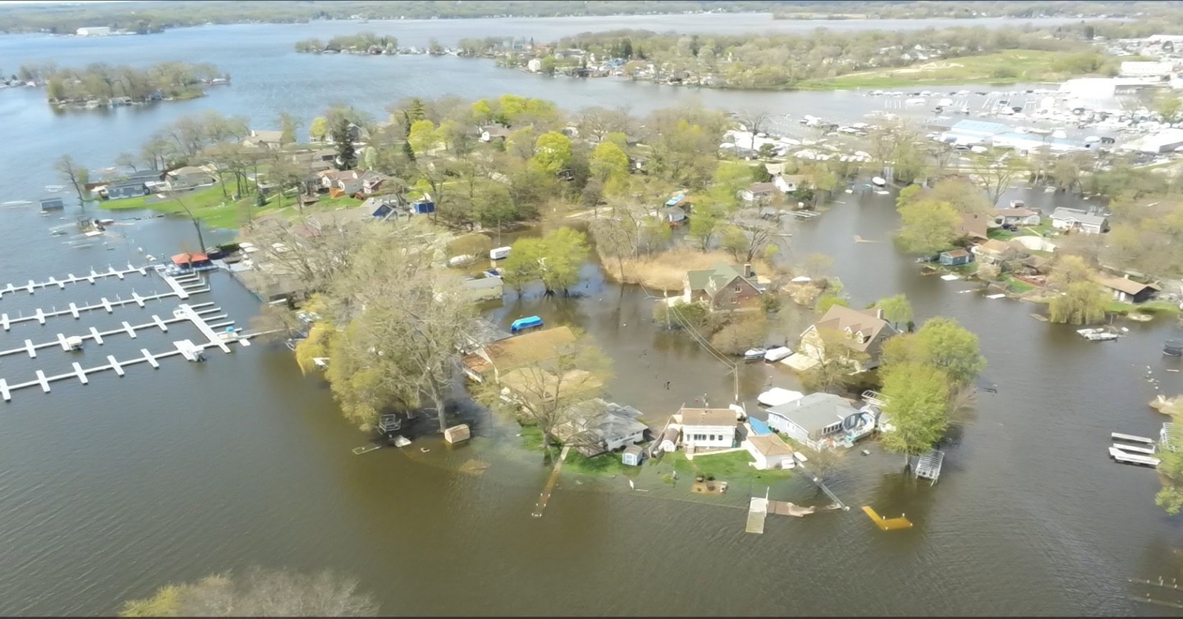
 Flood levels along the Fox River and Chain O’ Lakes in Lake and McHenry counties are trending downward for the first time in over a week, the National Weather Service (NWS) is reporting on its website. | Photo: Lake County Government
Flood levels along the Fox River and Chain O’ Lakes in Lake and McHenry counties are trending downward for the first time in over a week, graphs available at the National Weather Service (NWS) website showed Saturday morning.
NWS charts show rising floodwaters along the Fox River and Chain O’ Lakes crested during the day Thursday and remained the same Thursday night and into Friday morning.
Gages associated with the NWS website show that flood levels were down about 2 feet in New Munster, Wisc., while water levels were down two-tenths of an inch in Antioch and Fox Lake, and one-tenth of an inch in Algonquin.
New Munster gauge heights are important because the Wisconsin gauge is a precursor to flood levels recorded in Antioch and on the Chain o’ Lakes.
 Flood levels along the Fox River and Chain O’ Lakes in Lake and McHenry counties are trending downward for the first time in over a week, the National Weather Service (NWS) is reporting on its website. | Photo: Lake County Government
When the New Munster gauge shows flood levels, it means flood levels will hit Antioch the next day.
Barring any additional rainfall, water levels should start to recede through the remainder of the weekend and into the start of next week, gauges are showing.
All gauges are still above moderate flood levels.
Charts released on the National Weather Service website show water levels topped out at nearly 2 feet over normal flood stage along the Fox River in Antioch, while the Fox River in Algonquin topped out three feet over flood stage.
Water levels at the McHenry Dam reached a high of three feet over normal high water levels, the NWS is reporting.
The Des Plaines River crested earlier this week and continues to drop, the NWS shows.
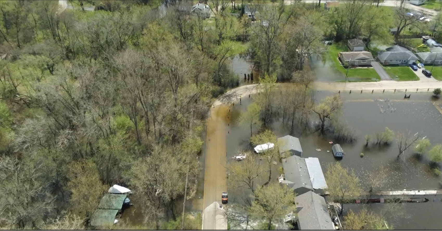
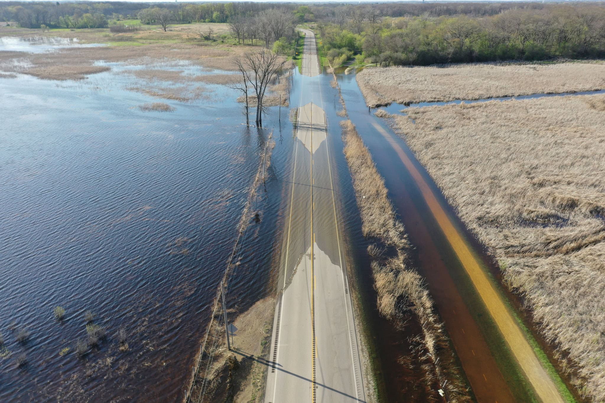 The Fox River has far surpassed flood stage, resulting in flooding in McHenry County following recent heavy rain that caused River Road in unincorporated McHenry to be shut down. | Photo: McHenry County Division of Transportation
Flood stage along the Fox River raised a flood alert to the highest level earlier this week as residents faced road closures and flooded homes in Lake and McHenry counties.
The Lake County Stormwater Management Commission (SMC) said Wednesday they raised the current Flood Threat Alert status to “Red.”
“This is SMC’s highest stage and signals that Major Flooding is occurring in Lake County. It is mostly contained to the Upper Fox River and Chain O’Lakes area as well as the Lower Fox River in the Barrington area, but is substantial in multiple areas,” the SMC said.
SMC teams are actively out in the field, continuing to survey the areas to record flood impacts and gather information.
Lake County and McHenry County both remain under flood warnings until further notice.
 The Fox River has far surpassed flood stage, resulting in flooding in McHenry County following recent heavy rain that caused River Road in unincorporated McHenry to be shut down. | Photo: McHenry County Division of Transportation
Numerous roads, yards, structures and areas of parkland are flooding along the Fox River Chain O’ Lakes.
Buildings are threatened along River Street, Johnson Street and Maiden Lane in East Dundee, the NWS said.
North Harrison Street is threatened near Riverside Park in Algonquin and Washington Street is threatened in Carpentersville.
Water Street, Edwards Avenue and Elgin Avenue are threatened in East Dundee. Bayview Road, along with low-lying areas of Festival Park in Elgin, are also threatened.
The NWS said there was minor flooding along the Des Plaines River from the Illinois-Wisconsin State line downstream to Des Plaines.
The Des Plaines River stage was 8.2 feet at 9:30 a.m. Wednesday. The flood stage is 7 feet. It has since reduced.
Agricultural and parkland are inundated near the Des Plaines River, while residential property is threatened near the river. It may drop below flood stage this weekend.
In Lake County, Grand Avenue was shut down from O’Plaine Road to Route 21 in Gurnee but has since reopened, while Route 59 from Route 22 to Scott Road in North Barrington remains closed.
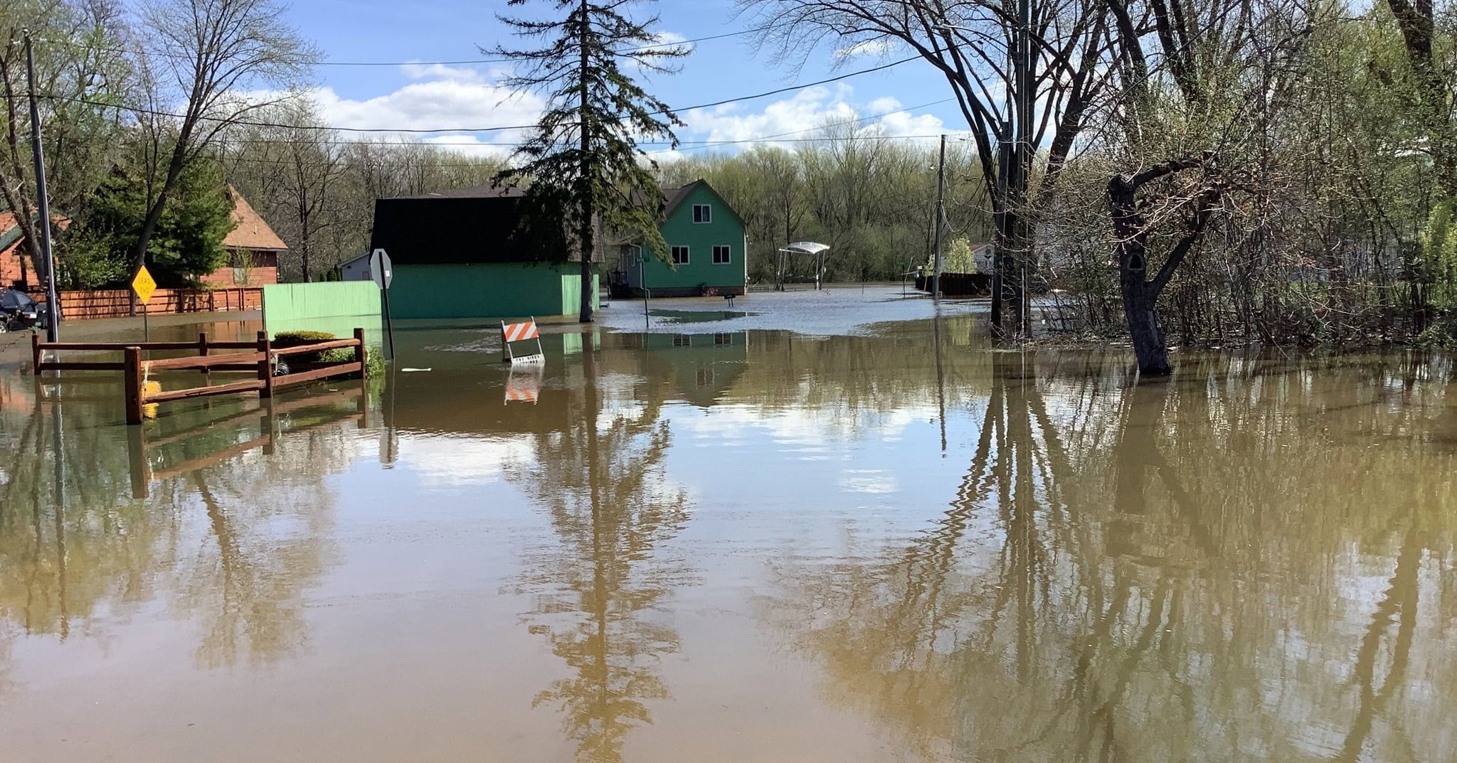 The Fox River and Des Plaines River, along with lakes, have surpassed flood stage and caused flooding in Lake County and McHenry County following recent heavy rain. | Photo: Lake County Government
Grand Avenue between North Holly Avenue and Keystone Avenue in Fox Lake is shut down due to high water.
The Village of Fox Lake said a free self-service sandbagging station is available to Fox Lake residents at the village’s salt and gravel facility near the Public Works building.
Rawson Bridge Road is closed from Tuxedo Lane to west of Roberts Road in Port Barrington, which falls on the border of Lake and McHenry counties, due to flooding.
The McHenry County Sheriff’s Office said Wednesday that the flooding across McHenry County continues to cause road closures as water levels are expected to rise.
“Barricades and closure signs have been placed to help keep people safe, protect nearby homes and property, and allow emergency crews to get where they need to go,” the agency said.
Sheriff’s officials told motorists not to attempt to cross or drive around barricades in that area.
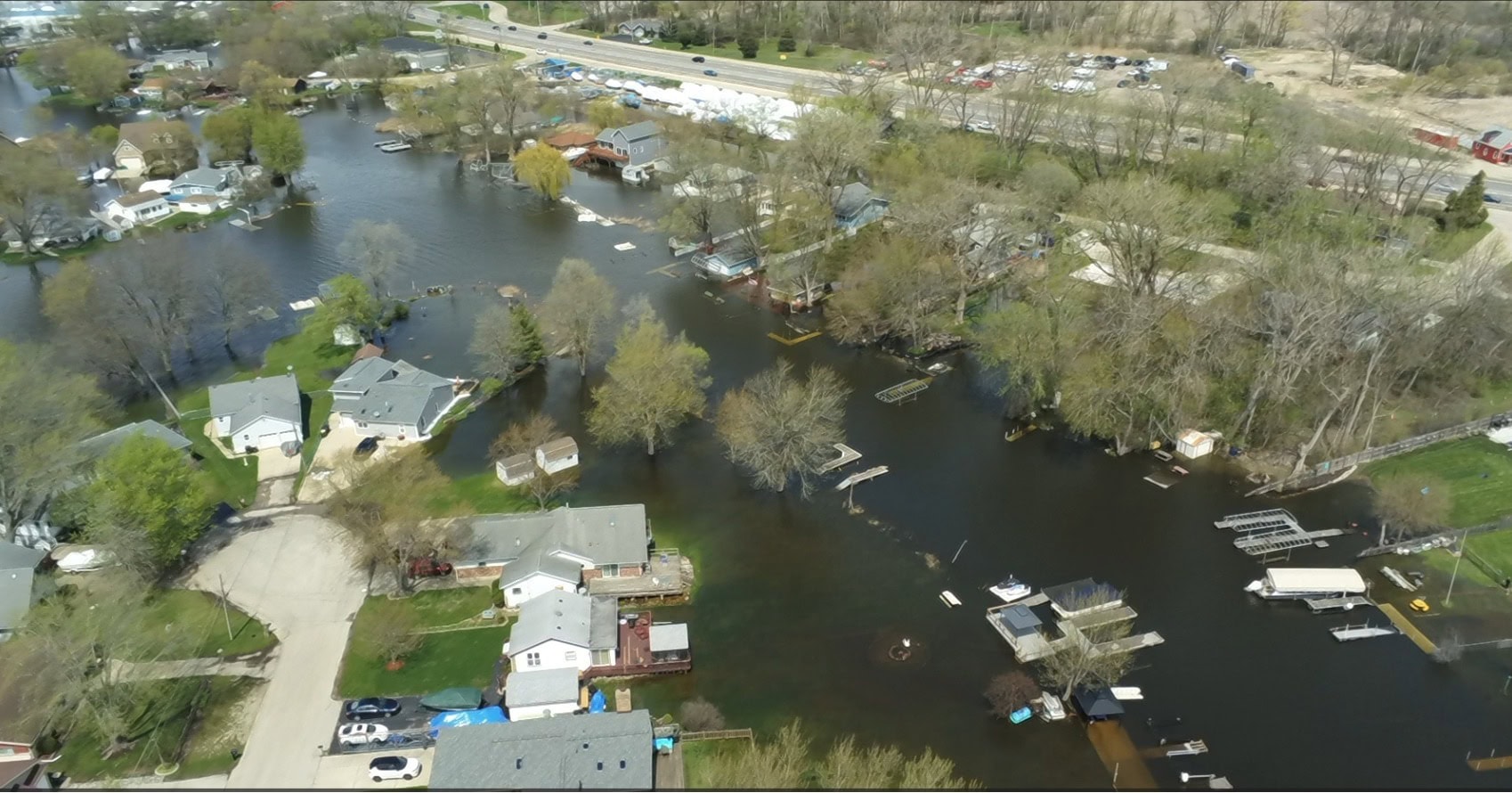
 Flood levels along the Fox River and Chain O’ Lakes in Lake and McHenry counties are trending downward for the first time in over a week, the National Weather Service (NWS) is reporting on its website. | Photo: Lake County Government
“It is dangerous, illegal, and can cause additional damage to nearby properties. We ask everyone to be a good neighbor during this time by respecting closures, avoiding unnecessary travel in flooded areas, and giving crews room to work.”
The sheriff’s office also reminded motorists that drivers who ignore the barricades or closure signs may be ticketed.
Health officials say people are urged to avoid floodwaters whenever possible and to wash their hands thoroughly with soap and warm water if they come into contact with the water.
“DO NOT drink water from a private well that has been flooded. The water may be contaminated with bacteria and other contaminants. Use bottled or disinfected water until you know your water is safe,” county officials said.
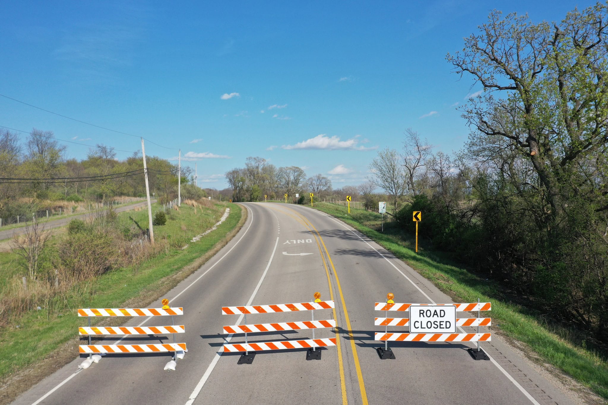
The McHenry County Division of Transportation (MCDOT) said it is closely monitoring county roadways as rising water levels encroach on the pavement, including onto segments of River Road in unincorporated McHenry near Moraine Hills State Park.
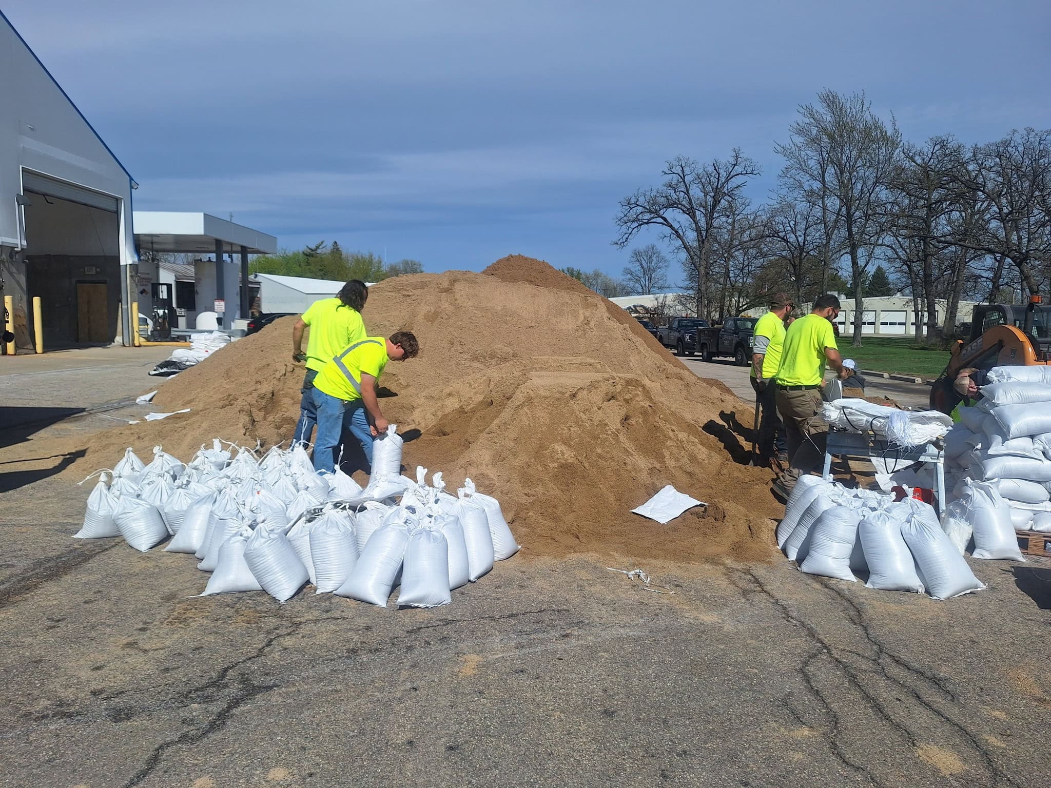 Fox Lake employees filled sandbags earlier this week when flood levels reached critical levels. | Photo Village of Fox Lake
MCDOT announced on Tuesday that it was closing River Road from McHenry Dam Road to West Fernview Lane due to the rising waters.
“The MCDOT is taking this step to ensure public safety, as the water is now too deep for vehicles to safely navigate. The County will continuously monitor road conditions and reopen the route as soon as it is safe for travel,” the transportation division said regarding the River Road closure.
Motorists are advised to seek alternate routes around the section of River Road, allow for extra travel time and follow all posted closure signs.
“Your safety is our top priority. Please respect the barricades, find an alternate route, and never drive through standing water. We will reopen River Road as soon as the water recedes!” MCDOT said Wednesday.
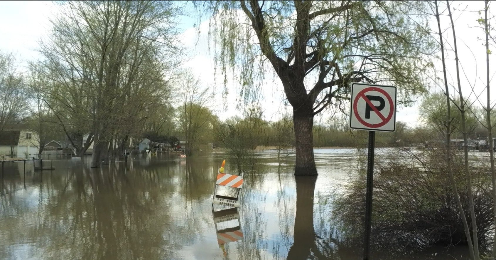 The Fox River, along with the Chain O’ Lakes, has surpassed flood stage and caused flooding in Lake County and McHenry County following recent heavy rain. | Photo: Lake County Government
McHenry Township said they have shut down Circle Drive from Hilltop Drive to Christine Avenue due to water on the road.
“We know people are interested in seeing the flooded areas, but please do not drive through standing water. It only causes more damage to homes. These people are going through a very hard time we don’t need to make it any worse,” the township said.
The Spring Grove Fire Protection District said members of Explorer Post 1800 spent part of last weekend assisting with filling sandbags for those experiencing flooding at their homes.
The Village of Algonquin said Public Works continues to maintain sandbag supplies at all six designated locations near the Fox River.
Residents who wish to take precautionary measures are encouraged to do so.
“Some Village public properties are beginning to take on water. Residents are asked to exercise caution near the Fox River and surrounding areas. The Village will continue to monitor river levels and issue updates as conditions change,” the village said.