
Currently, we’re seeing our longest dry streak of the year with no rain in Boston since August 1.
At the very least, the dry spell will last through Wednesday, making it 12 days without any rain. In addition, we are going to experience another heat wave. For many areas, this will be the third heat wave of the summer.
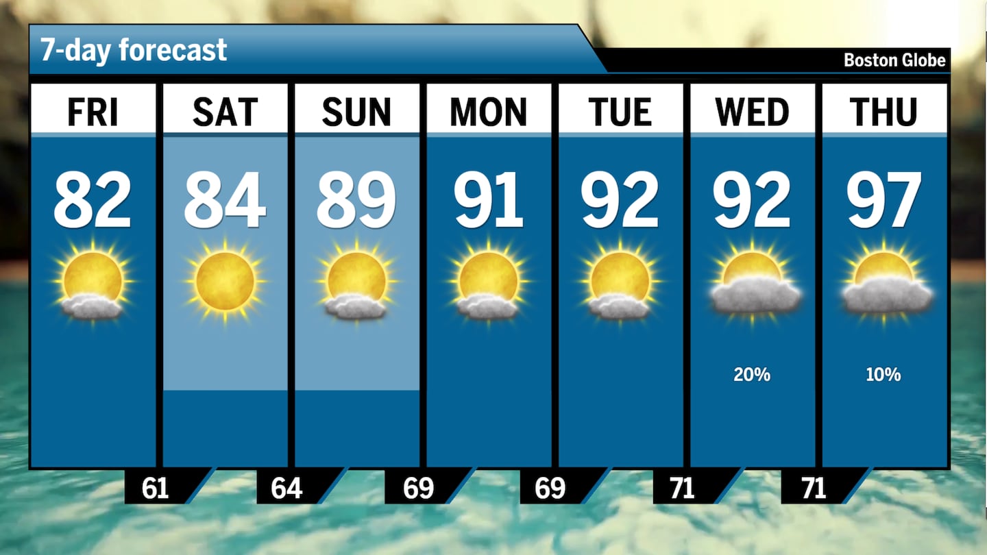 A look at the forecast for Boston over the next seven days. Heat wave incoming.Boston Globe
When you combine these two things, we could end up with a flash drought situation, which happens when drought develops very rapidly due to a lot of moisture loss.
So far, an official drought designation is confined to southeastern Massachusetts, especially Cape Cod and the Islands. But when there’s a lot of heat without any rain, the soil can dry out rapidly due to something we refer to as evapotranspiration.
This is the amount of moisture leaving the soil through plant leaves, and also just direct evaporation out of the ground. The combination can mean that we lose gallons of water a day from small areas of the soil.
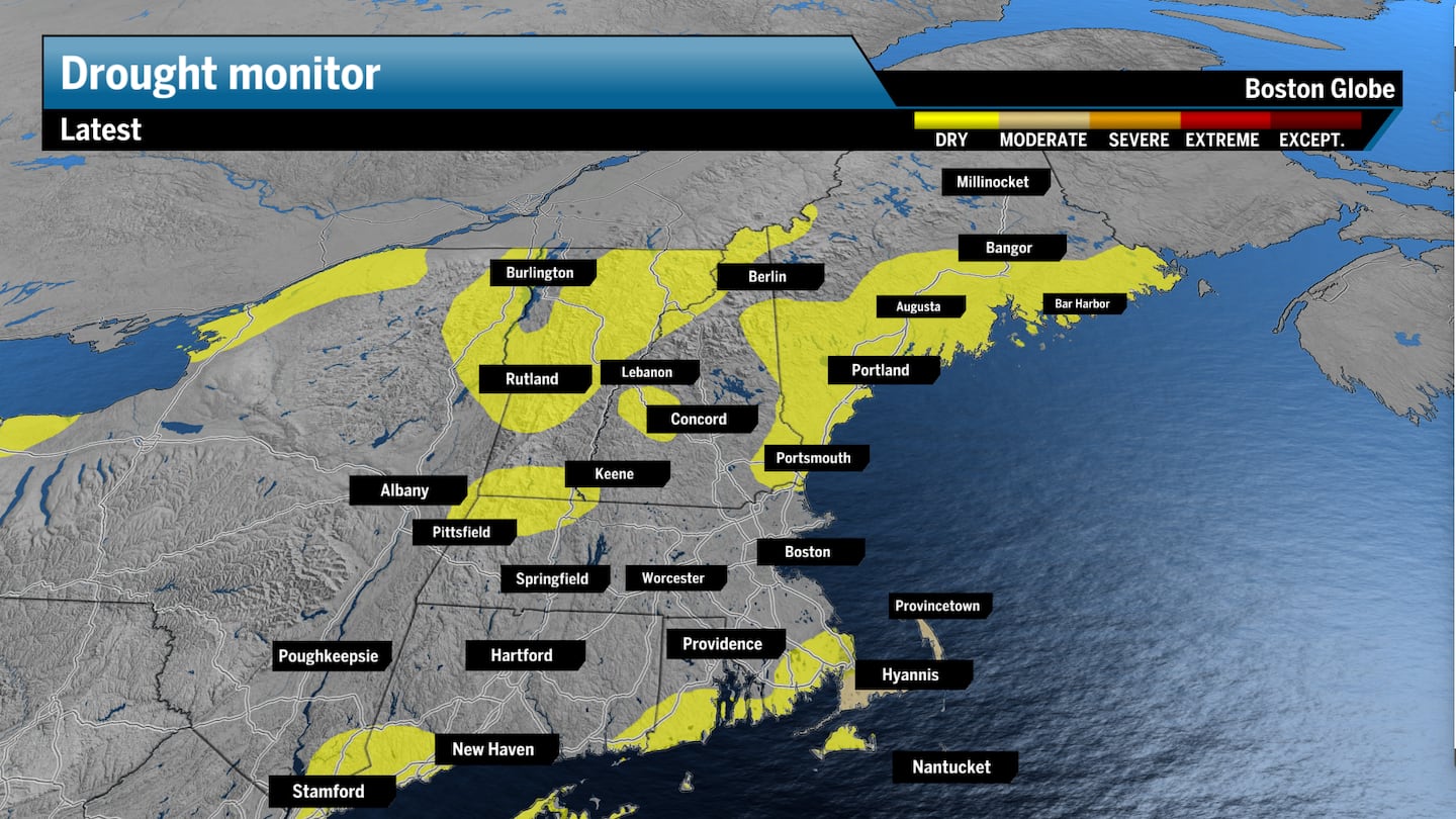 Some spots across Northern New England and extreme Southern New England have become abnormally dry.Boston Globe
The dryness is due to a upper-level pattern, which is evolving into a strong heat dome or ridge of high pressure. When we get these ridges of high pressure, they don’t allow clouds or precipitation to form, and this is why you’re seeing sunshine in the forecast day after day into the middle of next week.
 A ridge of high pressure will build heat across New England starting Sunday and spilling into the next work week.Pivotal Weather
Eventually, the ridge will break down, temperatures will cool, and we will see more rainfall. But when this occurs is still unclear.
One way the dry spell could snap is a tropical system. And it wouldn’t be surprising for a storm to break the lack of rainfall for parts of New England. The tropics are becoming more active, and depending on the exact configuration of a ridge of high pressure near us, it could pull a tropical system northward into the area.
New England has not seen a hurricane reach its shore since Bob in 1991. Typically, New England averages a landfalling hurricane once every 11 to 12 years. We’ve seen multiple hurricanes throughout the 1950s and early 1960s, but it’s been more than 30 years since our last.
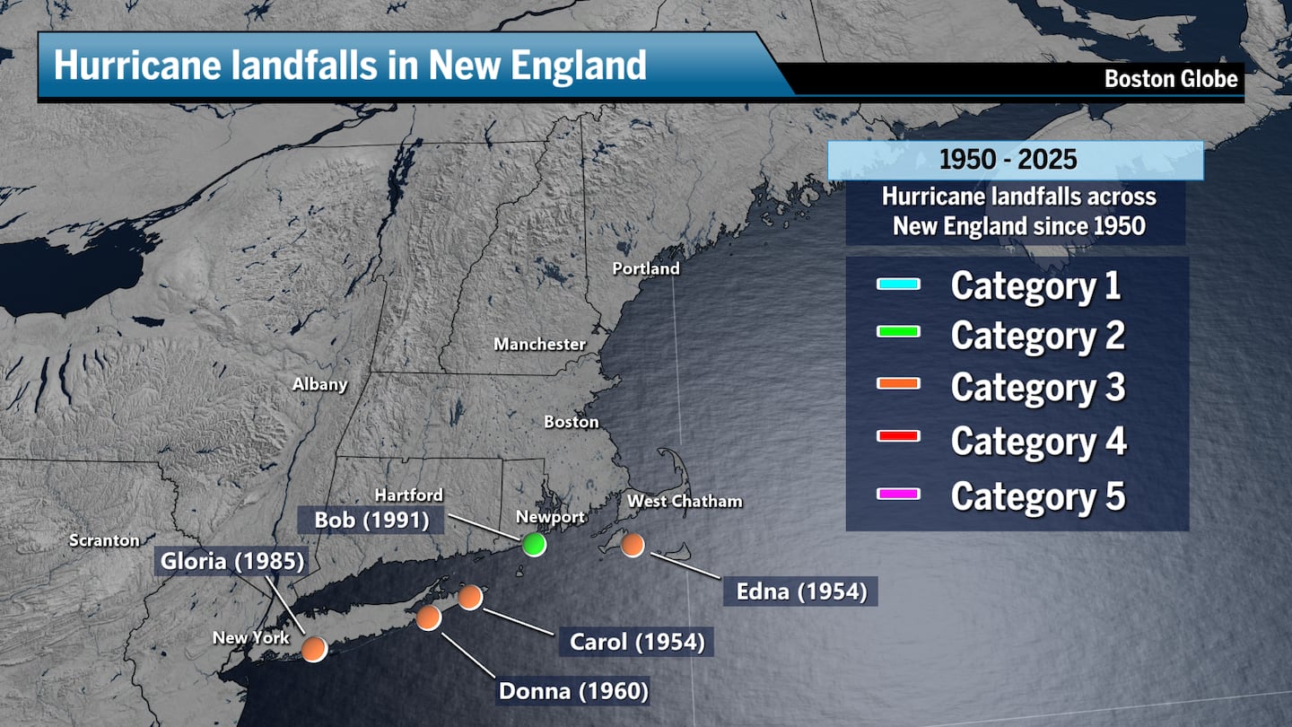 Hurricanes that made landfall near New England since 1950.Boston Globe
The main point here is that we are entering a prolonged stretch of hot and dry weather. For those of you who are growing anything in the garden, weeding and watering are the orders of the next week until we break out of this pattern.
Ken Mahan can be reached at ken.mahan@globe.com. Follow him on Instagram @kenmahantheweatherman.