
Energy and moisture from the remnants of Arthur will move across our area the next couple of days. That will result in a significant flooding risk across our area and some strong to severe storms will be possible.
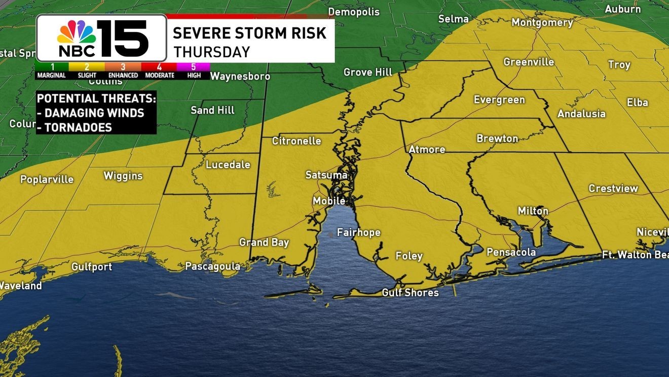
The Flood Watch in effect across our area has been upgraded to a Particularly Dangerous Situation. Through Friday, rounds of showers and storms could result in additional 6-12″ of rain with localized totals in excess of 15″ being possible. For our Thursday, the Weather Prediction Center has issued a rare level 4/4 HIGH risk of excessive rainfall across our area. There’s also a level 2/5 slight risk of severe weather which means scattered severe storms are possible. If storms become severe damaging winds and isolated tornadoes will be possible.
Thursday will bring rounds of showers and storms. It might not rain all day, but in some locations, you could see several rounds of rain which would result in the significant flooding risk. Just keep in mind, at any point, there’s a good chance that heavy rain could find you. Stay alert to the changing weather, have multiple ways to receive alerts, and heed any warnings that are issued. If you live in a flood prone area, have a plan in place just in case to seek higher ground. If you have to travel, be aware of the weather and if you encounter a flooded road, turn around, don’t drown!
Outside of any showers or during breaks, expect mostly cloudy skies with highs in the 80s. There’s also a Coastal Flood Advisory for coastal and central Mobile & Baldwin Counties that will run from 10AM-7PM Thursday.
Friday will bring more potential of seeing heavy rain with most of the area included in a level 3/4 moderate excessive rainfall risk. The entire area will also be in a level 1/5 marginal severe risk. Like Thursday, outside of any storms, it’s partly sunny to mostly cloudy skies with highs in the 80s.
Rain chances will remain slightly elevated on Saturday, however, our weather will start to gradually return to normal with a 50% rain chance with highs near 90. By Sunday into early next week it’s typical summertime with highs in the 90s, lows in the 70s, and daily rain chances around 20-40%.
Beach: There’s a HIGH risk of rip currents through Saturday. A high surf advisory is also in effect through 6PM Friday.
Topics: Arthur is now a post-tropical system. Its remnants will continue northeast in the coming days, bringing flooding concerns and strong storm potential to most of the southeast through Friday. The rest of the Atlantic Basin is quiet.