
News 9 Chief Meteorologist David Payne and Todd Lindley with NOAA National Weather Service Norman explain how severe weather alerts are issued.
Can you break down the different levels of severe thunderstorm warnings?
Todd Lindley: Starting in 2018, severe thunderstorm warnings were assigned what we call an impact-based warning category, or a tag at the end of the warning, which indicates the level of severity and the magnitude of the threat posed by that particular severe thunderstorm.
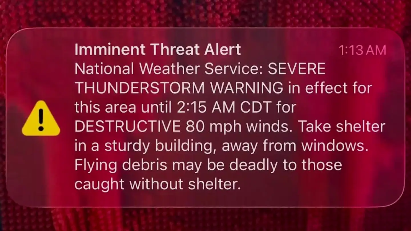
The highest category is what we call the Destructive Severe Thunderstorm Warning. That designation is used for severe storms that have the potential to produce winds greater than 80 mph and hail larger than baseball-sized.
David Payne: There are three levels. The base level is the lowest end of severe—winds around 60 mph with nickel-to quarter-sized hail. It’s severe, but on the lower end. The next level is “considerable,” which brings winds up to about 70 mph and hail up to golf ball size. The highest level is “destructive,” with winds of 80 mph or higher.
What did we see with last night’s storms?
David Payne: We didn’t have much hail, but we absolutely saw considerable damage with winds around 70 mph. We also reached that highest level—the “destructive” category—with winds between 90 and over 100 mph. That clearly falls under a destructive severe thunderstorm warning.
Todd Lindley: We had a very widespread and damaging severe thunderstorm complex move across Oklahoma, bringing widespread damaging winds, including a peak wind gust of 102 mph, measured by the Oklahoma Mesonet at Hinton, just west of the Oklahoma City metro area.
Those extreme wind speeds are what prompted the issuance of the higher-level, destructive severe thunderstorm warning.
What happens when that “destructive” warning is issued?
David Payne: When that word “destructive” is included in the warning, your phone will alert you just like it would for a tornado warning—especially in the middle of the night. It wakes people up immediately. That’s because winds of 80 mph or higher can be life-threatening.
How important are those overnight notifications?
David Payne: They’re critical. Late at night—midnight, 1 a.m., 2 a.m.—people are completely unplugged. They’re asleep and not paying attention to what’s happening outside. That alert system bridges that gap. It can absolutely be the difference between knowing and not knowing that dangerous weather is headed your way.
Could that warning system actually save lives?
David Payne: Absolutely. This system is a game-changer. When people get notified on their phone and turn on live coverage, it gives them real-time information. The storms we saw had winds strong enough to cause fatalities. Thankfully, that didn’t happen and I believe the warning system played a big role in that.
How often do you issue these destructive severe thunderstorm warnings?
Todd Lindley: These types of warnings are really quite rare.
Since 2018, the National Weather Service Forecast Office in Norman has issued a total of nine destructive-tagged severe thunderstorm warnings covering western and central Oklahoma.
Why is this type of “destructive” alert so rare?
David Payne: It’s rare because we don’t frequently see thunderstorms producing winds of 80 to 90 mph or higher. These usually happen in the summer when the atmosphere is very hot and unstable. Even then, it doesn’t happen every year—sometimes not for a couple of years.
Can you tell me about the different alert sounds people may hear with these warnings?
Todd Lindley: A typical severe thunderstorm warning does not activate the Wireless Emergency Alert that you receive on your phone. Likewise, the medium-level category, which we call a Considerable Severe Thunderstorm Warning, also does not trigger that alert.
However, the Destructive Severe Thunderstorm Warning is the only severe thunderstorm warning category that activates the Wireless Emergency Alert system. That places it in a category much more similar to a tornado warning or even a considerable flash flood warning, indicating a higher threat to life and property.
How dangerous are these storms compared to tornadoes?
David Payne: Winds of 80 to 100 mph are comparable to an EF0 or low-end EF1 tornado—but spread out over a much larger area. A tornado hits a narrow path, but these storms can impact entire counties, affecting far more people at once.
What should viewers do if they get one of these alerts?
David Payne: Turn on live coverage immediately. We’re already on the air, tracking everything in real time. It’s also important to have multiple ways to receive warnings—apps, phone alerts, and broadcasts working together.
What made this storm system so strong?
David Payne: We had a lot of heat, humidity, and instability—basically a lot of fuel. The system started in Colorado and Wyoming and traveled hundreds of miles, strengthening as it moved. It became what we call a derecho—a long-lasting wind event causing widespread damage across multiple states.
Can these storm systems become life or death?
David Payne: Absolutely. Oklahoma weather can be intense, but it’s very survivable if you have a plan. Make sure alerts are turned on, keep your phone charged, and be ready to act when those warnings come through.
Todd Lindley: Severe thunderstorm warnings, unfortunately, are not uncommon in our part of the world, especially here in Oklahoma.
This leveled or categorized approach allows us to really differentiate those severe thunderstorms that are truly an imminent and immediate threat to life and property. It helps communicate with the public when a storm poses an exceptionally dangerous situation.