
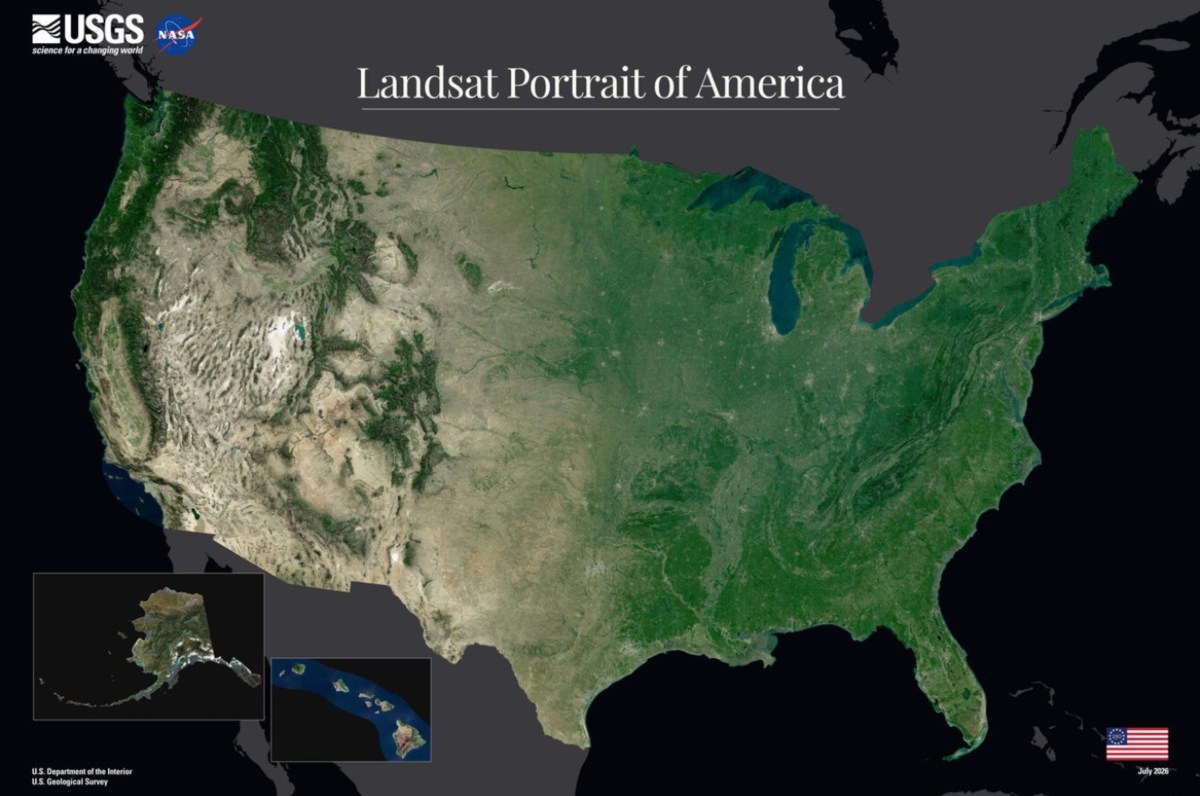
As the United States prepares to mark its 250th anniversary, the U.S. Geological Survey (USGS) has released a new satellite portrait of the nation that highlights how dramatically the American landscape has changed over the last half-century.
The satellite portrait is one of a number of projects associated with America 250, the nationwide commemoration of the 250th anniversary of the United States. According to the USGS, the new Landsat mosaic was created to mark the milestone and continues a tradition that began during the nation’s bicentennial celebrations in 1976, when the first satellite photomosaic of the contiguous United States introduced Americans to a new view of their country from space. The agency said the 2026 image reflects five decades of advances in Earth observation and provides a new perspective on the nation’s landscapes ahead of the semiquincentennial.
The image, produced using data from Landsat 8 and Landsat 9 satellites, offers a sweeping view of the country from the Pacific Northwest to Florida.
Read More on U.S.
The agency said the latest portrait was created by analyzing billions of pixels from the Landsat archive. Scientists compared cloud-free observations collected during the growing season and selected the images that best represented typical conditions at each location before combining them into a seamless national mosaic. Elevation data was then added to provide greater depth and contrast.
America in 1976 vs. 2026: Biggest Changes
One of the most notable differences between the two images is the color. The newest image from 2026 shows lots of green in the eastern U.S., with mostly tan or brown colors showcasing the more arid regions in the West. In the 1976 image, the colors were not as vibrant.
Another major noticeable difference is the size of the Great Salt Lake in Utah. The Great Salt Lake has been shrinking for decades as less water reaches the lake from the rivers that feed it, a trend driven by a combination of drought, rising temperatures and heavy upstream water use. Scientists say diversions for agriculture, industry and growing urban communities have significantly reduced inflows, while hotter conditions linked to climate change have increased evaporation from the lake’s surface.
The decline has exposed large stretches of lakebed, raising concerns about dust pollution, threats to wildlife habitat and impacts on industries that depend on the lake. Researchers and policymakers have warned that restoring more water to the lake will be critical to preventing further ecological and economic damage.

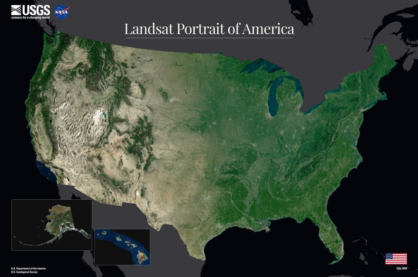
The new map also doesn’t appear to cover the full surface area of the Great Lakes, as opposed to the 1976 image.
Newsweek reached out to the USGS by email for comment.
Beyond serving as a visual celebration of America at 250, the map underscores the value of Landsat’s long-running record of environmental change. Since the first Landsat satellite launched in 1972, the program has provided the world’s longest continuous space-based record of Earth’s land surface, helping scientists document changes ranging from urban expansion and agricultural development to shrinking reservoirs, wildfire impacts and shifting coastlines.
USGS said Landsat imagery has become a key part of the nation’s decision-making infrastructure over the past five decades. Farmers use the data to monitor crops and irrigation, water managers track snowpack and reservoir conditions, and emergency officials rely on satellite imagery to assess the impacts of floods and wildfires. The extensive archive also allows scientists to measure long-term changes in landscapes across the country.
What Happens Next
Looking beyond the America 250 celebration, NASA and the USGS are already preparing the next chapter of the Landsat program. The agencies plan to launch Landsat 10 in 2031, a next-generation Earth-observing mission designed to continue the world’s longest space-based record of Earth’s land surface.

Check out all of Newsweek’s coverage of America’s 250th anniversary:
Contact Newsweek editors on this story: Samantha Beech and Gray R. Thomas