
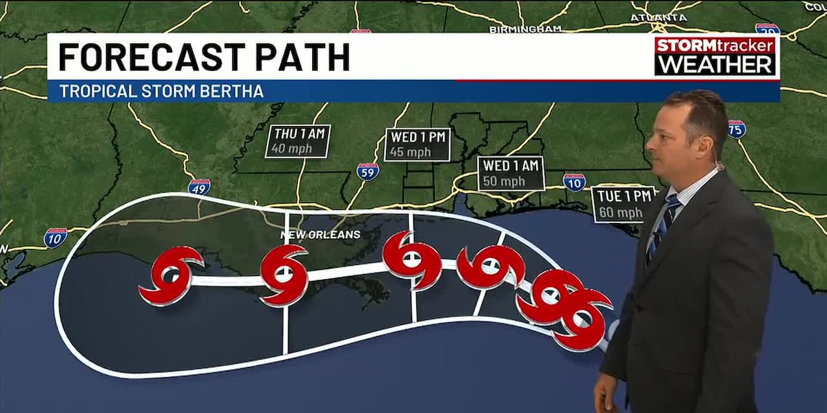
MOBILE, Ala. (WALA) – Tropical Storm Bertha has formed over the northeastern Gulf and will continue tracking west near the northern Gulf Coast through Wednesday. For the Mobile and Pensacola area, this is not expected to be a major tropical event, but it will bring dangerous beach conditions, breezy weather, and occasional tropical showers, especially along the coast. Because of these impacts, Tuesday and Wednesday are STORMtracker Alert Days.
Tuesday & Wednesday: Greatest Impacts Near the Coast
Bertha will remain a lopsided tropical storm, with dry air and strong wind shear keeping most of the heavy rain and strongest thunderstorms well offshore.
For inland communities, expect a mix of sunshine and clouds with only isolated showers. Many locations will stay dry for much of both days while temperatures climb into the lower to middle 90s. Heat index values will still reach 100° to 105°, making the heat another important concern.
Along the immediate coast, rain chances are higher with occasional tropical showers and downpours moving onshore. Even here, it won’t be a washout, and there will be long stretches of dry weather between passing rain bands. Coastal wind gusts of 25 to 30 mph are expected, with a few gusts approaching 40 mph possible Tuesday night into Wednesday.
Rainfall totals should generally remain 1 to 2 inches, with isolated higher amounts where heavier showers persist. Localized nuisance flooding is possible in poor drainage areas, and there remains a very low risk of a brief tornado or waterspout near the coast.
Beach Impacts: The Main Story
The most significant effects from Bertha will be along the beaches and Gulf waters.
High rip current risk continues through Wednesday.Rough surf will build, with waves reaching 6 to 10 feet.Minor coastal flooding is possible around times of high tide, especially in vulnerable locations.Small craft should remain in port as seas become rough and winds increase.
Even if the sun is shining, the Gulf will be dangerous. If red flags are flying, stay out of the water.
Looking Ahead
Bertha is expected to move westward toward Louisiana later this week while gradually weakening. As it pulls away, the Gulf Coast will transition back to a more typical summer pattern with hot, humid afternoons and scattered showers and thunderstorms. High temperatures will return to the mid-90s, with heat index values once again climbing above 100° through the weekend.
Copyright 2026 WALA. All rights reserved.