
PORTLAND (WGME) — Another hot day is on tap for Monday across Maine, with feel-like temperatures in the upper 80s and low 90s. Dew points will be dropping through the week.
Looking ahead, there will be a few chances for rain showers and thunderstorms including a low-end risk on Monday and again later this week.
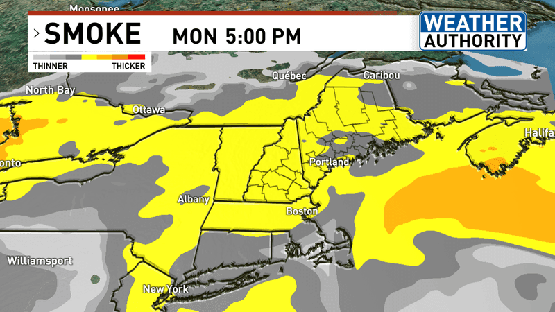
Monday’s wildfire smoke. (WGME)q
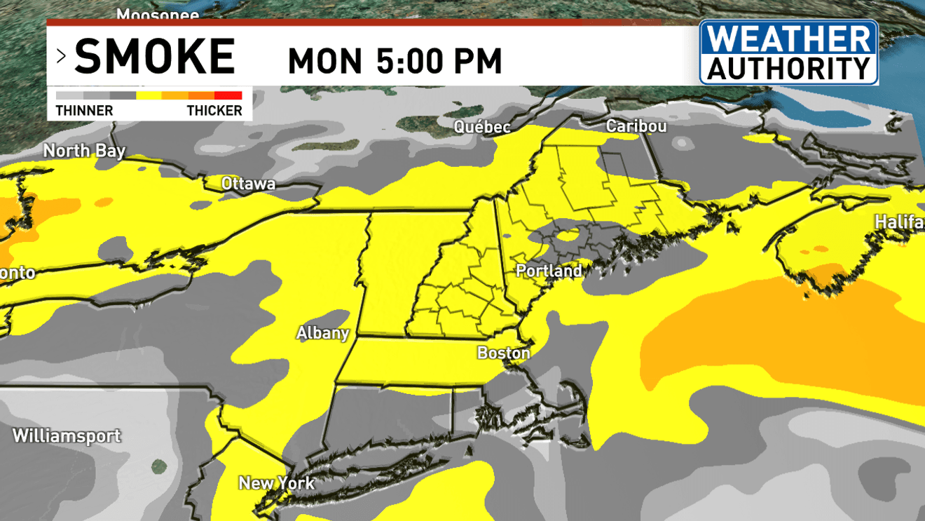
There will also be some thin-to-thick wildfire smoke present on Monday afternoon across Maine and New Hampshire.
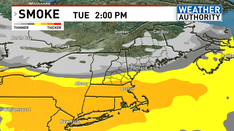
Tuesday’s wildfire smoke. (WGME)q
Most of the thick wildfire smoke will push off towards southern New England by Tuesday.
At this time, there are no major impacts to air quality.
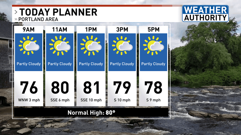
Planner for Monday, August 10th. (WGME)
Partly sunny conditions are on tap for Monday.
High temperatures will run in the 80s, but when combining heat and humidity, feel-like temperatures will run in the 80s, even near 90 degrees over the interior.
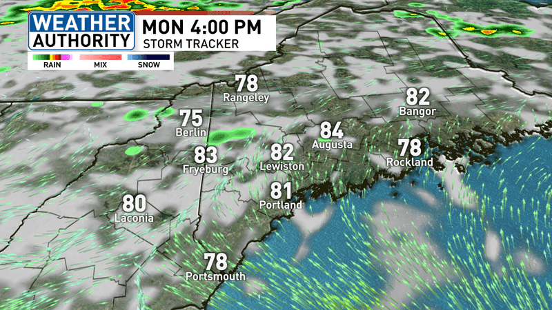
There will be a chance for an inland/mountain rain shower/thunderstorm on Monday afternoon.
Most will stay dry, however.
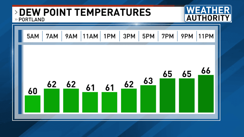
Monday’s dew points. (WGME)
Dew points will be dropping heading into the work week.
Expect lower humidity compared to late last week and the weekend, but it will still feel sticky throughout the day.
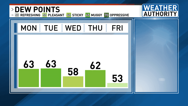
This trend will continue into Tuesday and Wednesday.
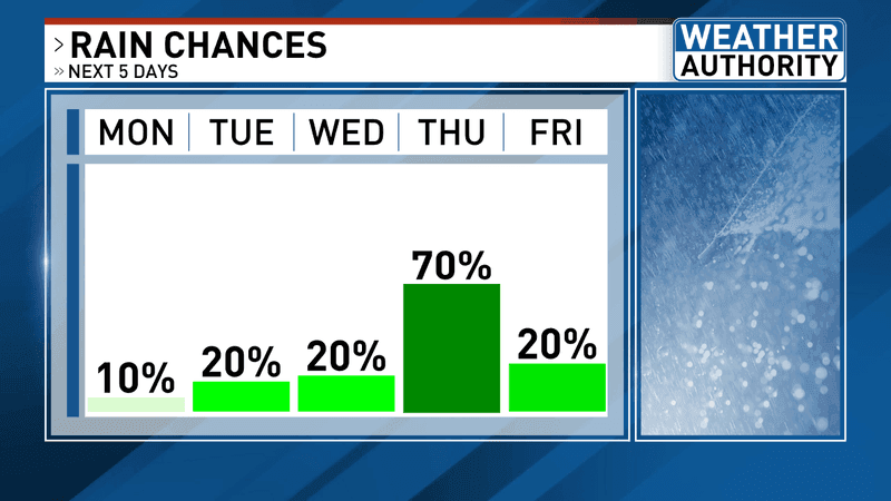
Rain chances ahead. (WGME)
As mentioned, the next chance for widespread showers and thunderstorms approaches late Wednesday and Thursday.
Stay tuned for more updates on that threat with a cold front moving through.
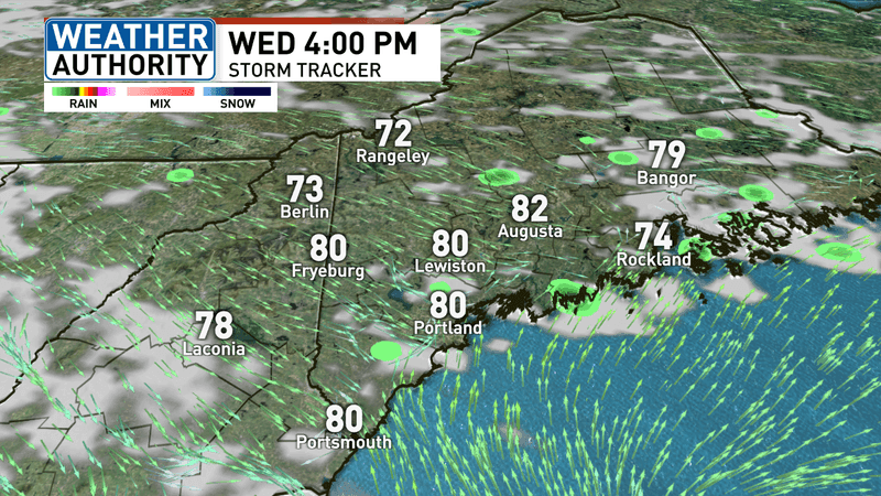
Wednesday afternoon. (WGME)
The shower/thunderstorm threat will start up along the coastal plain by mid-to-late afternoon on Wednesday.
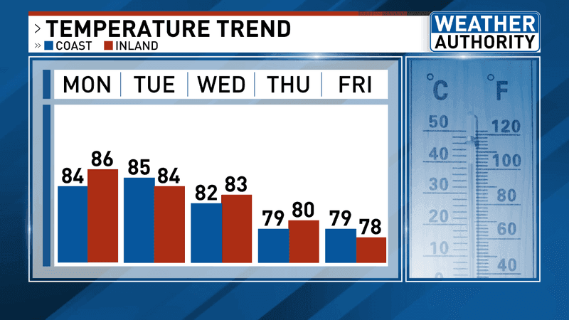
Temperatures ahead. (WGME)
High temperatures this week will run into the 80s through Thursday.
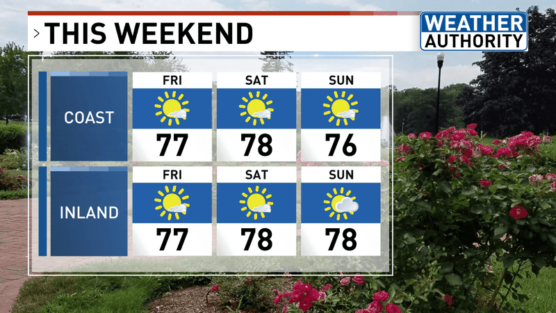
After that, 70s will kick in through the weekend.
Friday into Sunday look sunny and refreshing.
Do you have any weather questions? Email our Weather Authority team at weather@wgme.com. We’d love to hear from you!