
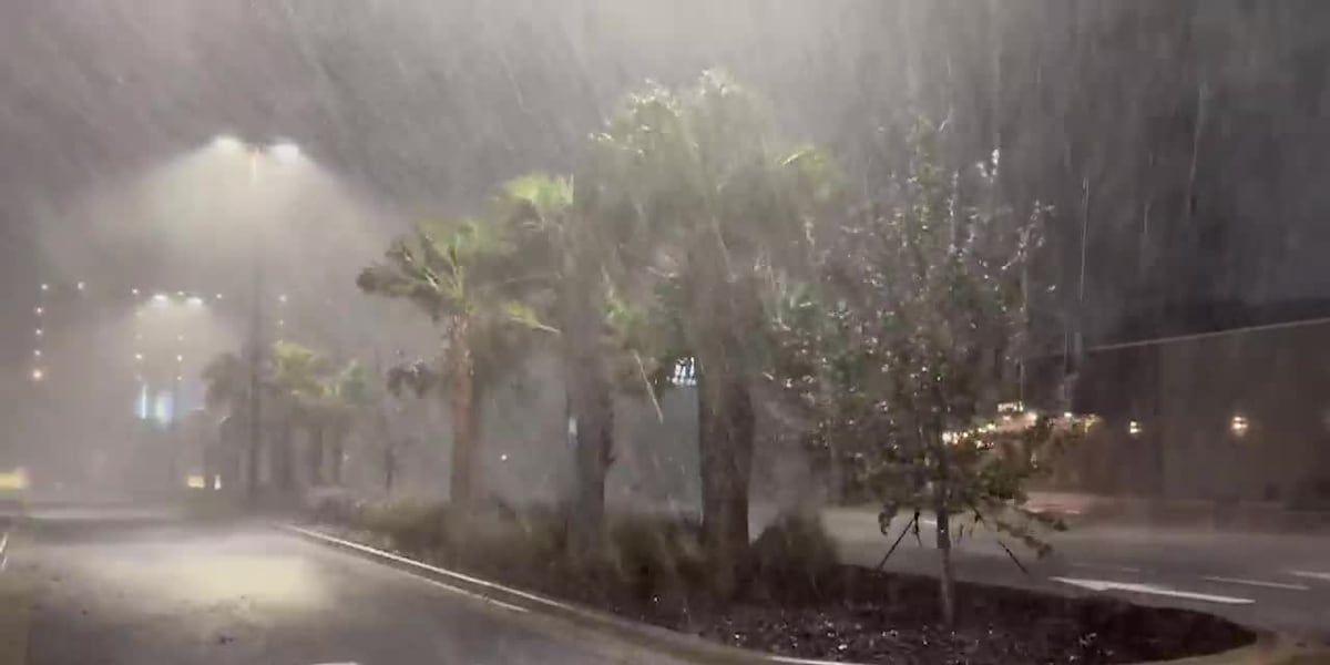
CHARLOTTE, N.C. (WBTV) – More than 10,000 Carolinians were without power Saturday as the aftermath of Hurricane Isaias swept across the region, according to Duke Energy’s outage map.
“The remnants of Hurricane Isaias are bringing heavy rain, gusty winds and power outages to some areas of the Carolinas,” Duke Energy officials said in a notice to customers.
“Our crews are working to assess damage and restore power as safely and quickly as possible. Please stay away from downed power lines and continue to monitor local conditions.”
Outage maps show that more than 3,600 customers were without power in western North Carolina, specifically throughout counties under a flash-flood watch.
The Asheville Fire Department reported about 4,000 people without power in the Grove Park and Haw Creek areas in Buncombe County.
“Duke Energy has informed us they are bringing in crews from the coast to stage in Asheville. Duke crews are in storm mode,” officials said Oct. 10.
According to Duke Energy’s outage maps, thousands of people were without power as of Saturday evening — including outages in Stanly County (1,832), Buncombe County (1,327), Jackson County (1,097), New Hanover County (1,077), Carteret County (1,017) and Macon County (913).
Buncombe, Jackson and Macon counties were among the western North Carolina counties under a flash-flood watch as Isaias brought heavy rain to the region.
The National Weather Service said heavy rain could cause excessive runoff, flooding creeks and streams, and inundating low-lying areas. The heaviest rain was expected along the Blue Ridge Escarpment, with 5 to 6 inches possible in some areas.
Ashe and Watauga counties were also under a flood watch through Sunday evening because heavy rainfall could cause river, creek and street flooding.
North Carolina Emergency Management said Saturday it was sending the Mooresville swiftwater rescue team to western North Carolina to respond to potential flooding and other emergencies.
12 people were sent to Yancey County, which was under a flash-flood watch through Sunday afternoon, to respond to potential flooding and life-safety emergencies.
Union Power Cooperative also reported more than 100 outages as of Saturday evening, mainly along the North Carolina-South Carolina border. The cooperative did not provide a reason for the outages.
Blue Ridge Energy, which serves northwestern North Carolina, including the Boone area, similarly reported more than 100 outages.
It was not immediately clear when power would be restored for customers affected in the Charlotte area.
Customers can report outages and check their status on Duke Energy’s website.
Click here for the latest forecast from our First Alert Weather team.
Storms expected Friday evening
The remnants of Hurricane Isaias were expected to bring heavy rain and gusty winds to the Carolinas, prompting flood watches, wind advisories and river flood advisories across the region.
The National Weather Service warned that excessive rainfall could cause flash flooding, while strong easterly winds could bring down tree limbs and power lines.
Rain chances were near 100% through much of Saturday in the Charlotte region, with temperatures in the 60s and a high near 70. Northeast winds of 10 to 20 mph could gust to 40 mph.
Click here to see all active weather alerts and warnings for the Charlotte region.
Heavy rain could cause flooding
Forecasts show widespread rainfall of 2 to 4 inches in parts of northwestern North Carolina and southwest Virginia, with locally higher totals of 5 to 6 inches possible near Meadows of Dan, Boone and Blowing Rock.
In parts of northeast Georgia, western North Carolina and upstate South Carolina, periods of rain were expected to intensify Saturday afternoon and continue into early Sunday morning.
The heaviest rainfall was forecast along the Blue Ridge Escarpment, including near the North Carolina-South Carolina border west of Interstate 26 and from Saluda to Grandfather Mountain.
The rain could cause creeks and streams to rise, flood low-water crossings and inundate other low-lying areas.
Isolated landslides were also possible on slopes altered by construction, such as embankments and cut slopes.
Broad River could rise above flood stage
The National Weather Service issued flood advisories for parts of the Broad River watershed, where heavy rain could cause river levels to rise into Monday.
Near Boiling Springs, the river was forecast to crest at 11.7 feet Monday morning, above its 10-foot action stage.
A crest above the 12-foot minor flood stage was also possible. Near Shelby Highway, the river was forecast to reach 13 feet, its action stage, and a crest above the 16-foot minor flood stage could not be ruled out.
Flooding could affect farmland, woodlands, low-lying roads, greenways, parks and other areas near the river.
Residents with interests along the Broad River were advised to monitor the latest stream levels and forecasts at NOAA Water.
The weather service said the gusts could blow around unsecured objects, bring down tree limbs and power lines, and cause power outages, particularly in higher elevations.
Gusty winds could bring down trees
East winds of 15 to 25 mph, with gusts up to 55 mph, were forecast in Ashe and Watauga counties and parts of Virginia and West Virginia.
Elsewhere across portions of northeast Georgia, western North Carolina and upstate South Carolina, winds of 10 to 20 mph with gusts up to 46 mph were expected.
The weather service said the gusts could blow around unsecured objects, bring down tree limbs and power lines, and cause power outages, particularly in higher elevations.
Avoid downed power lines
When power lines are knocked down amid severe weather, it’s vital to avoid them at all costs.
Here are some safety tips regarding downed power lines, from Duke Energy:
Stay away from power lines that have fallen or are sagging.Consider all power lines — as well as trees, limbs and anything else in contact with power lines — energized and dangerous.Report all power line hazards to Duke Energy at 800-228-8485, or contact your local emergency services department or agency.Keep children and family pets away from areas where lines may have fallen (backyards, fields, schoolyards, etc.).If a power line falls across a car that you’re in, stay in the car. If you MUST get out of the car due to a fire or other immediate life-threatening situation, do your best to jump clear of the car and land on both feet. Be sure that no part of your body is touching the car when your feet touch the ground.Power outage maps for all power companies in Carolinas
Below is a list of real-time outage maps for all power companies in North Carolina and South Carolina, as provided by officials.
North CarolinaDuke Energy 800-769-3766Duke Energy Progress 800-419-6356Dominion Energy 866-366-4357Albemarle EMC 800-274-2072Blue Ridge Electric 800-448-2383Brunswick EMC 800-682-5309Cape Hatteras Electric Coop. 866-511-9862Carteret-Craven Electric Coop. 800-682-2217Central EMC 877-766-6769City of Concord – Concord Electric SystemsEdgecombe-Martin County EMC 800-690-0657Energy United 800-386-4833Four County EMC 888-368-7289French Broad EMC 828-649-2051Halifax EMC 800-690-0522Haywood EMC 800-951-6088Jones-Onslow EMC 800-681-4146Lumbee River EMC 800-683-5571Pee Dee EMC 800-693-0190Piedmont EMC 800-449-2667Pitt and Greene EMC 800-622-1362Randolph EMC 877-736-2633Roanoke Electric Cooperative 800-358-9437Rutherford EMC 800-521-0920South River EMC 800-338-5530Surry-Yadkin EMC 336-356-4141Tideland EMC 800-637-1079Tri-County EMC 800-548-4869Union Power 800-794-4423Wake EMC 800-743-3155Wilson Energy 252-399-2424
North Carolina outage resources are provided by the North Carolina Department of Public Safety.
South CarolinaUpload your weather pictures, videos
Share your photos or videos of the winter weather to the QCit album below, and we may feature them on TV or online. Be sure to note what city, town, or village the photo was taken in — we may come check it out for ourselves.
Download the free WBTV Weather app on your mobile device to receive weather alerts and to get the latest forecast on the go. You can also catch the latest forecast on WBTV’s streaming app — find it in the app store on your smart TV or streaming device.
Copyright 2026 WBTV. All rights reserved.