
This morning feels a bit summer-like, with temperatures moving into the 60s and 70s and a bit of humidity.
We warm up quickly this afternoon, hitting the 80s by 1 PM. This, paired with lots of sunshine and a little bump in humidity, will bring our “feels-like” temperatures into the lower 90s.
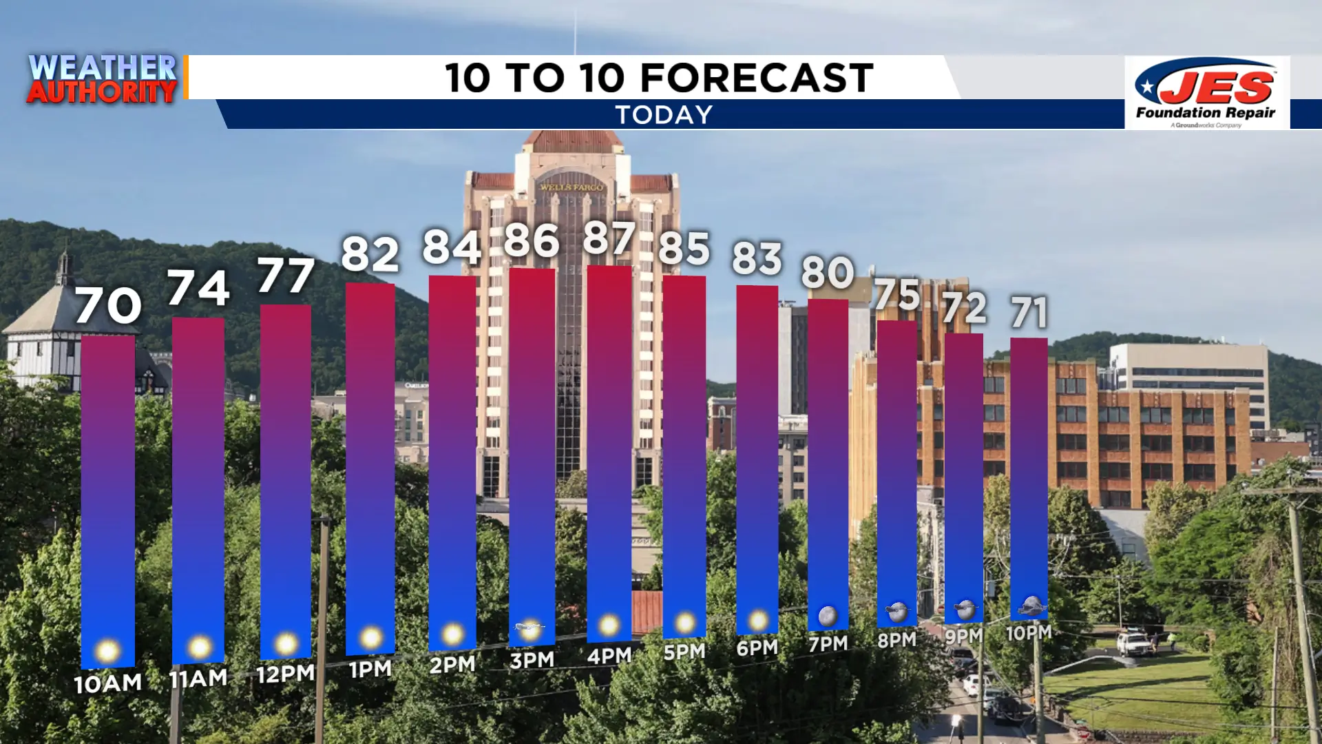 10 to 10 (WSLS 2026)
A look at our setup shows why we are significantly above average for this time of year. A ridge of high pressure will continue to build in and bring the potential for record-breaking high temperatures for the majority of our region.
This same ridge of high pressure will keep any and all precip to our north for the rest of the day, and bring the chance to break our high temperature records for Wednesday.
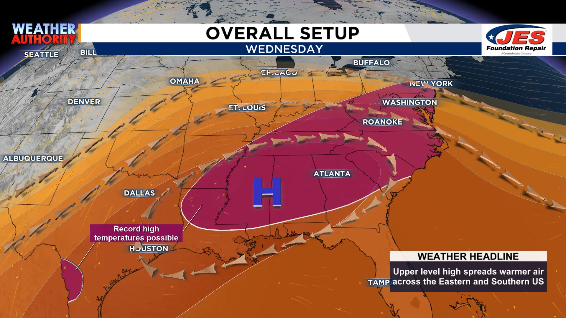 Setup (WSLS 2026)
Here is a closer look at our forecasted temperatures compared to our records! We are expected to break all records, barring the NRV Zone where the current record may be tied.
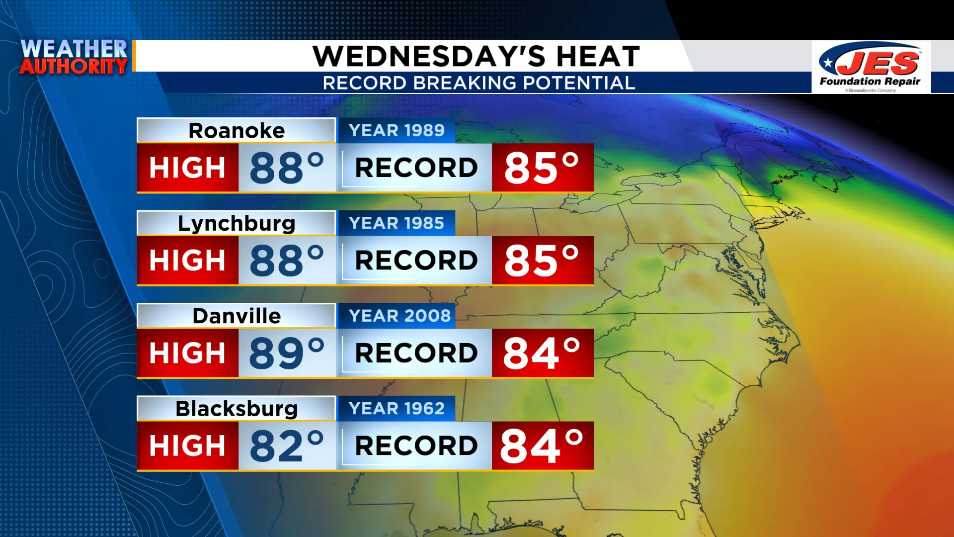 Records (WSLS 2026)
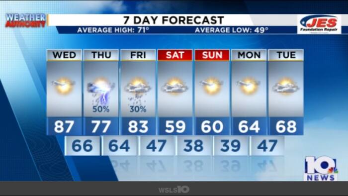
This ridge of high pressure will erode as we move into the weekend and a cold front takes control! That cold front will bring the chance of rainfall both Thursday and Friday, which will also bring a significant temperature drop for the weekend! We go from the 70s on Friday to the upper 50s on Saturday!
It’ll be a fantastic weekend to get outside and get to the pumpkin patch or other fall activities. Have a fantastic Wednesday!
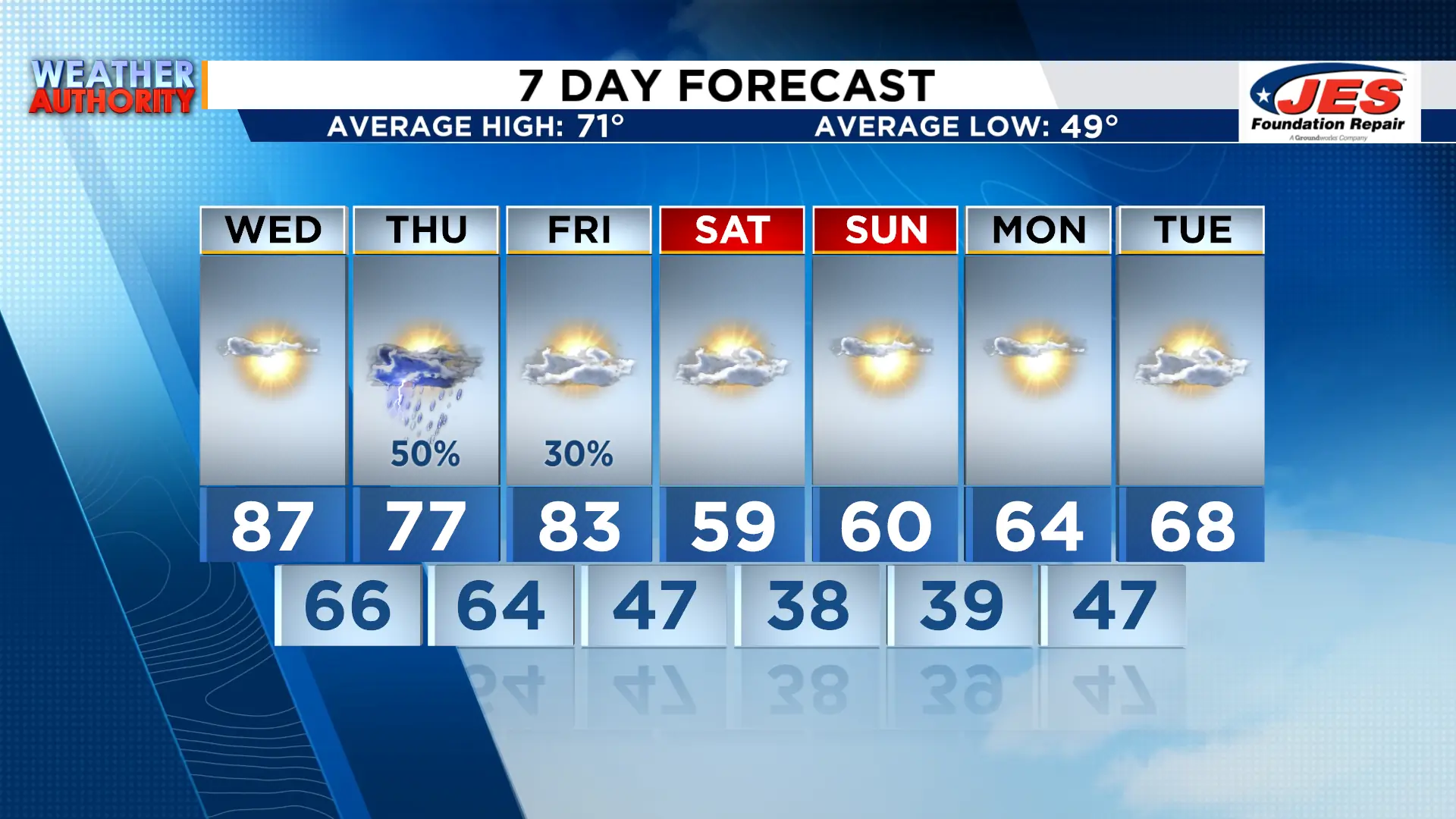 7-Day (WSLS 2026)
Copyright 2026 by WSLS 10 – All rights reserved.