
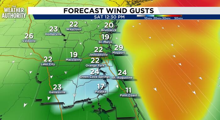
Another beautiful day in the neighborhood. It’s a little warm under these mostly sunny skies. Temperatures continue above average through Friday. Cooler and windy this weekend as a nor’easter settles in.
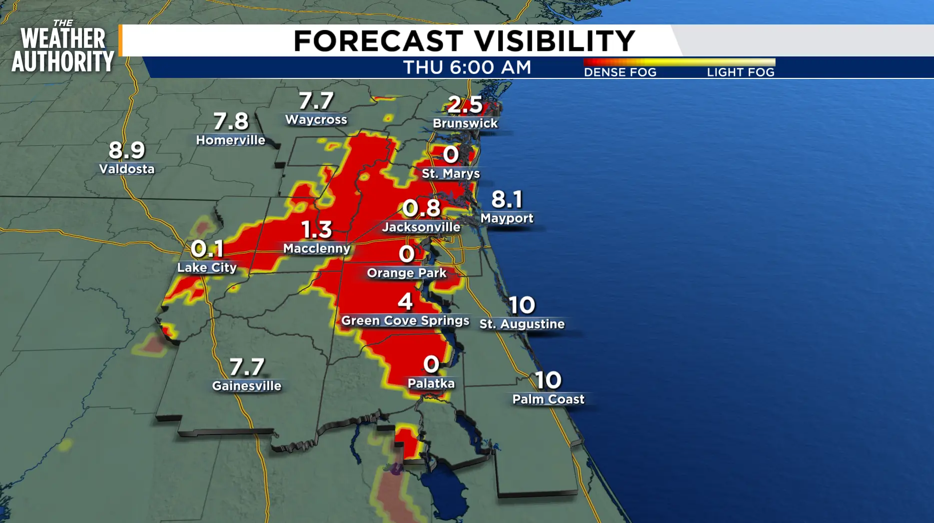
High pressure will build across the area with a shift in the wind and weather pattern Friday night. Light to calm winds and cooling temperatures will bring late night and early morning fog across inland areas Thursday and Friday. Dense fog advisories will be possible.
 . (.)
The warmer than average temperatures continue through Friday as another local Nor’easter starts late Friday, early Saturday. A cold front will move southeast across the area Friday night through early Saturday morning as a strong area of high pressure builds from the northwest. This will send a surge of winds from the northeast following the frontal passage.
Increasing wind this weekend as temperatures drop by about 8 to 10 degrees. Sustained onshore winds, along the coast, will reach 20-25 mph, gusting near 30-40 mph. Along with the onshore winds, isolated to scattered showers, with a few embedded storms will be possible.
Elevated onshore winds will continue Sunday and linger through early next week. This will prompt a High Risk of Rip Currents, along with minor tidal flooding through early next week. Additional beach erosion is expected as well due to the weakened state of the beaches from the last northerly blast.
The greatest chance of rain will be near and along the beaches of NE Florida, beginning Saturday afternoon and continuing through Tuesday. The flooding potential will be highest along the Duval, St. Johns and Flagler coastlines and the St. Johns River Basin during times of high tide.
Tonight: Mostly clear, cool and calm with patchy to dense fog.
Thursday: A cool start under mostly clear skies with patchy to dense fog inland. Mostly sunny to partly cloudy skies. Lows in the 60s inland, 60s to low 70s along our beaches. Highs in the 80s. Wind: NE 5-10 mph. Patchy fog overnight.
Friday: Mostly sunny to partly cloudy then becoming cloudy late with a slight chance of showers, 10-20 percent. Lows in the 60s and 70s. Highs in the 80s. Wind NW/S 5-10 mph. The wind will switch to the northeast late Friday night, early Saturday morning.
Looking ahead: Cooler and windy this weekend, with a slight chance of wind-driven showers.
Sunrise: 7:29 a.m.
Sunset: 6:56 p.m.
Copyright 2026 by WJXT News4JAX – All rights reserved.