
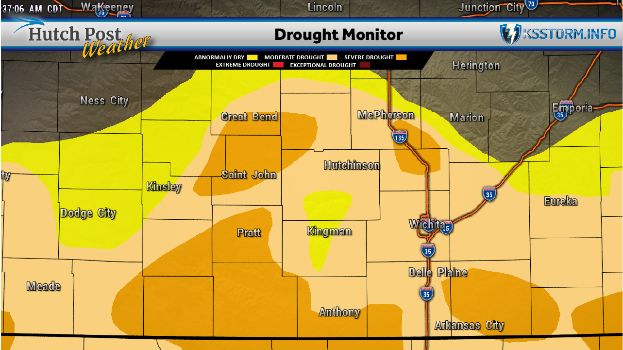
 Kansas Drought Monitor – Oct. 13, 2026 – Map data courtesy of National Drought Mitigation Center
Kansas Heat Continues as South-Central Rainfall Deficit Persists
Kansas recorded temperatures 14 degrees above normal during the week ending Oct. 13, while rainfall fell well short of average, according to the latest Kansas Climate Report and Drought Update.
South-central Kansas was the state’s warmest region, averaging 74.3 degrees for the week. The region also remained the state’s driest compared with normal for the year, with a precipitation deficit of 2.44 inches.
The report, prepared by Kansas State University Assistant State Climatologist Matthew Sittel, showed a statewide weekly average temperature of 72.8 degrees. About 80% of Kansas Mesonet stations reached 90 degrees at least once during the reporting period.
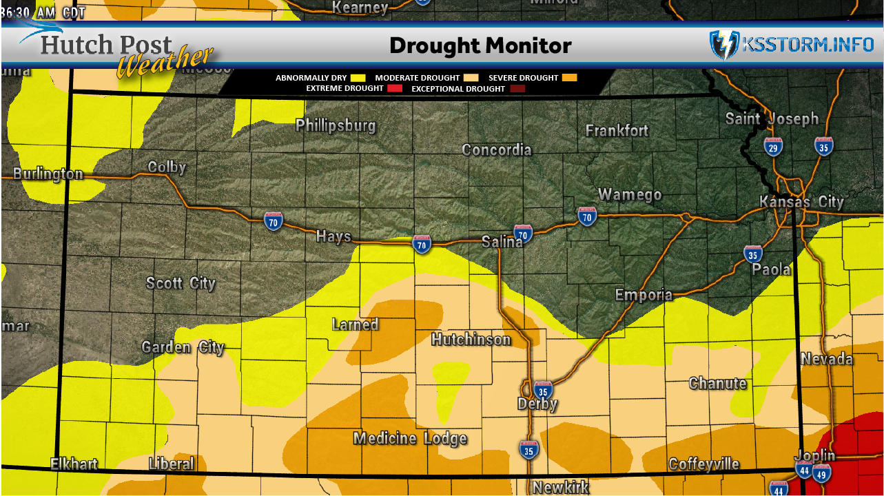
 Area Drought Monitor – Oct. 13, 2026 – Map data courtesy of National Drought Mitigation Center
Lake City in Barber County exceeded 90 degrees all seven days. Ashland and Plainville recorded the week’s highest temperature of 97 degrees on Oct. 12.
Overnight temperatures also set records. Russell’s official low of 72 degrees on Oct. 12 marked its latest fall occurrence of a low in the 70s. Dodge City recorded a similar milestone with a low of 71.
Despite the heat and mostly dry conditions, drought coverage changed little. About 31% of Kansas remained in moderate or severe drought, while 51% was free of drought or abnormal dryness. The only change in the Oct. 13 U.S. Drought Monitor was the addition of abnormally dry conditions in part of Miami County.
 Click here to visit Diesel Control Technicians website
Statewide precipitation averaged just 0.04 inches for the week, compared with a normal of 0.57 inches. South-central Kansas received the highest regional average at 0.13 inches.
The report noted that additional rain fell after the Tuesday morning cutoff used to assess drought conditions. That rainfall will be evaluated in the next weekly report.
The heat also increased moisture loss. Estimated water loss from grass and soil averaged 1.25 inches statewide, compared with a normal of 0.89 inches.
Through Oct. 13, Kansas’ average October temperature stood at 68.6 degrees, or 8.7 degrees above normal. The report cautioned that cooler weather later in the month makes a record monthly average unlikely.
Data for this article was provided by Matthew C. Sittel, Assistant State Climatologist at the Department of Agronomy at Kansas State University.
The U.S. Drought Monitor is jointly produced by the National Drought Mitigation Center at the University of Nebraska-Lincoln, the United States Department of Agriculture, the National Oceanic and Atmospheric Administration and the National Aeronautics and Space Administration. Map data courtesy of NDMC.