
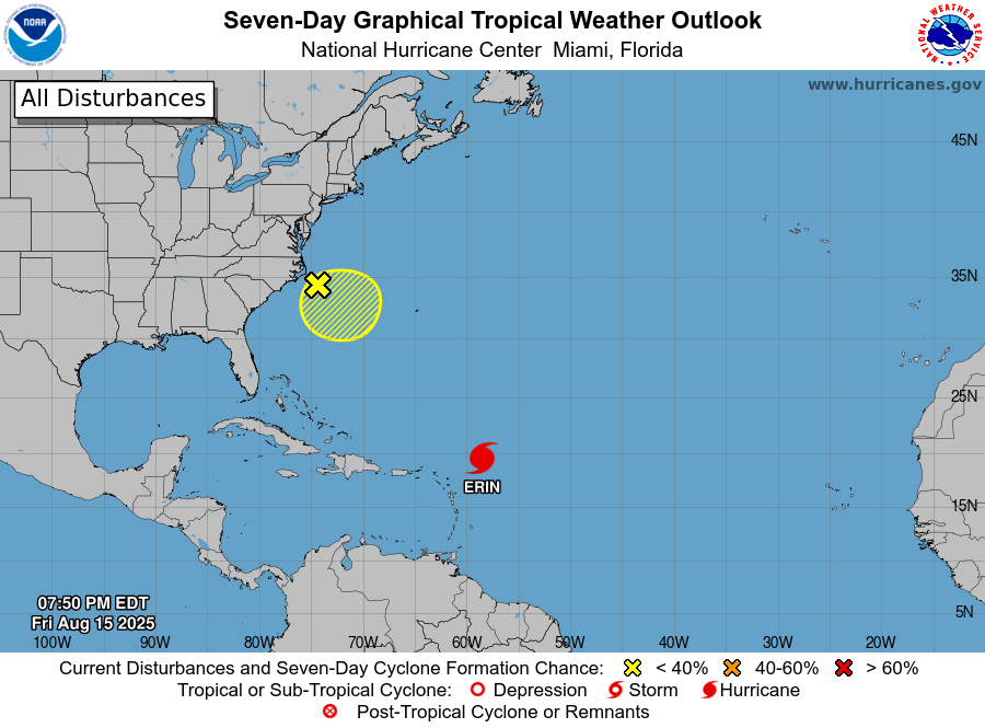
Outer rainbands from Erin are already brushing parts of the Leewards, with rainfall totals of 2 to 4 inches expected through Sunday, and isolated pockets up to 6 inches. Authorities warn that the downpours could trigger flash floods, urban flooding, and landslides in vulnerable areas.
Hurricane-force winds extend up to 30 miles (45 km) from the center, with tropical-storm-force winds reaching out 125 miles (205 km). Large swells generated by the system are forecast to impact the Virgin Islands, Puerto Rico, Hispaniola, and the Turks and Caicos this weekend, before spreading to the Bahamas, Bermuda, and the U.S. east coast early next week.
Forecasters expect Erin to maintain its west-northwest track through the weekend before turning north early next week, keeping its core just north of the Virgin Islands and Puerto Rico.